Blog

TDC Farming News

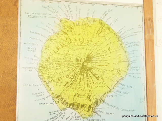
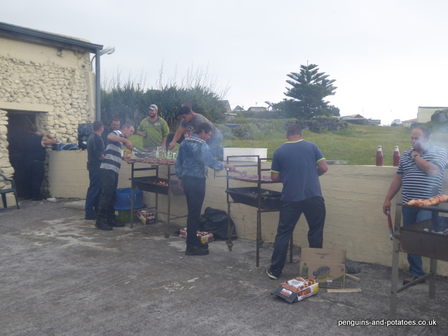
As you will find in any small community, it is quite easy here on Tristan for rumours and incorrect information to start circulating. In facing up to the reality of the situation, I have just put out a ‘Farming News’ paper, which has gone down exceptionally well. It gives folk a ‘from the horse’s mouth’ idea as to what we are trying to do, and I have had a number of people coming along with seeds for us to propagate. This is what I put out in the community:-

TDC Farming News                      Issue 1                          October 2017

The Department of Agriculture is aiming to publish a newsletter like this one from time to time. If anyone would like us to comment on any specific farming topic, please let us know.

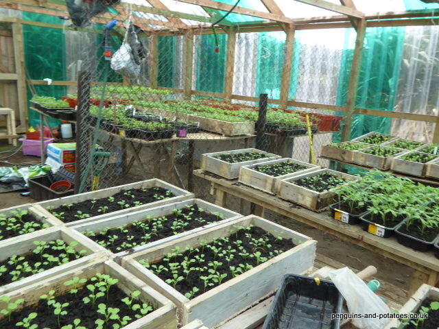
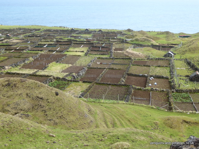
Greenhouses and Mission Gardens

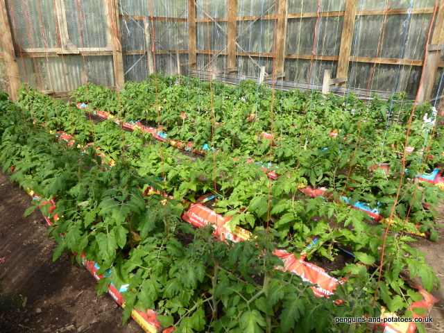
In recent months we have been able to make considerable progress on production in these garden areas. As well as growing plants that will produce food crops for sale, such as tomatoes, we are also growing plants that will end up being sold in the Agri Shop. These plants fall into three categories – indoor ornamental plants, outdoor ornamental plants, and plants for food production – all this is part of our mission to supply a service to the community. The thinking behind the production of vegetable plants for sale is that we have the facilities and skills to produce a range of strong, healthy plants that can be transplanted into peoples’ gardens when they are big enough to be able to withstand the many insects that are waiting to attack seedlings, and people will probably like being able to ‘kick start’ their own vegetable production without the risk of loosing small vulnerable seedlings.

The recent sale of tomato plants has been a big success. We hope to be able to follow up with cabbage, cauliflower and broccoli plants very soon. Keep an eye open for our notices as to what is coming into the shop. If anyone would like us to propagate any particular plants in the greenhouse, do please let us know.

Lime and Fertiliser

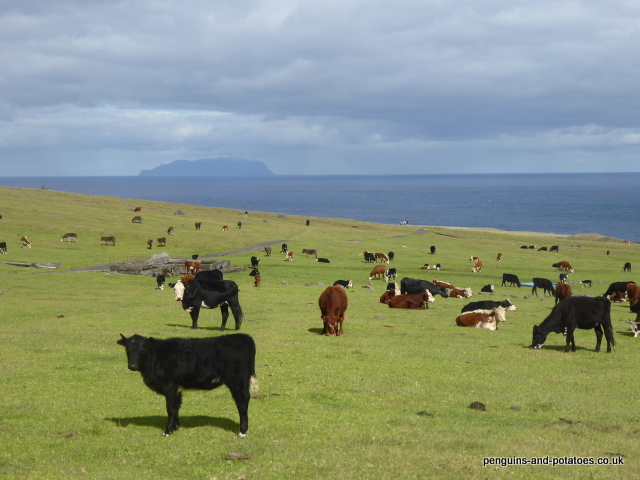
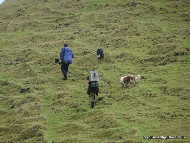
You may have noticed our team busy spreading fertiliser and lime in some of the pasture areas. This is part of an ambitious long-term programme to improve the grass production on the island, in order to help increase the feed available for the cattle.

Lime is being applied in order to raise the pH of the soil. A low pH means acid soil, and grass grows badly on ground that is acid. A pH of 6.5 to 7.0 is ideal for productive grasses, but many of the pastures are currently below 5.5.

I have been asked whether there is any problem with cattle grazing land that has been recently fertilised or limed. The fertiliser that we are using at present is prilled urea, specifically adding nitrogen. In some countries both urea and lime is deliberately added to cattle feed, and there will be no problem with cattle grazing on land that has been recently limed or fertilised with urea.

Bulls

 The very good news is that we are soon due to take delivery of two new bulls from South Africa. These are both Aberdeen Angus, one being a black Angus and the other a red Angus. We expect that these will be with us in time for the 2018 breeding season.

These two bulls will be key in improving the cattle blood-lines on the island. In the coming two months we should see the new calves born from the recent AI programme, and we look forward to seeing whether any cross-bred bull calves produced from AI are good enough to select for breeding in the future. In the meantime, with the new bulls quality natural breeding will be assured.
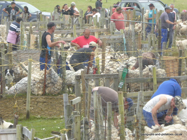
Ear Tags

 Some months ago the decision was made to identify cattle using ear tags, which will be pivotal to us being able to keep proper records, and for the identity of animals being followed from birth to death. Any people who watch Countryfile will be familiar with this sort of ear tag. The ear tags have now arrived on the island.

Each animal will be tagged twice, with a large tag on one side and a little button tag on the other side, both tags displaying the same number which will be the ID of the animal.

It is not intended that the ear tags will necessarily replace the traditional system of ear marking – it will be up to the individual owner to choose whether to ear-mark his calves as well, or whether to rely on the ID provided by the ear tags. We will of course be keeping a detailed record of each ear tag number, so that for example in the event that an animal is given or sold by one owner to another, the records will be updated to show the new owner.

It will take some time before we are able to obtain full benefit from the ear tag system. For example, once calves that are as yet unborn are tagged and fully mature the records that can then be referred to will be invaluable for the community and for the individual owner.

New Tractor

We are very pleased to be able to report that we have taken delivery of a new 4WD tractor, and this machine has now been commissioned and put into service.

Being brand new, this machine has the whole of its working life ahead of it. We feel that the tractor is a very sound investment that will play a key role in the important farming developments that are programmed. The tractor is a Massey Ferguson, and the controls are largely the same as the old 135’s and 240’s that are on the island, and are therefore familiar to our staff.

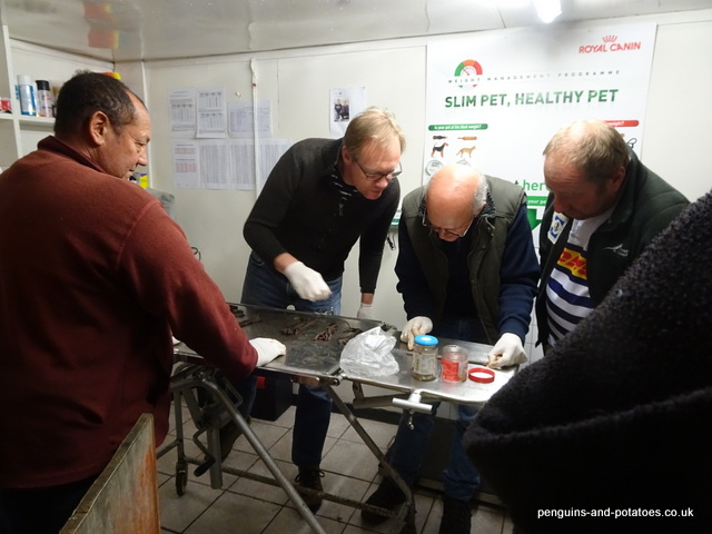
Livestock Mineral Deficiencies

Our visiting vet, Joe Hollins, has done some very interesting work by collating and analysing the results of blood and tissue samples taken from island livestock over a number of years

Joe has identified that there are substantial mineral deficiencies that are having a negative effect on the health of the livestock.

As a result, a consignment of salt / mineral blocks has been ordered and now received and distributed, and we are working through the herd to administer mineral boluses (stomach pills).

Alasdair Wyllie – Agricultural Adviser and Editor of TDC Farming News

Fundamentals of Farming on Tristan da Cunha

Tristan da Cunha is a tiny volcanic island deep in the South Atlantic, at around 37o south. The nearest land is Cape Town, some 1,600 miles to the east. It has a population of 260 people. Tristan was first occupied by a British garrison in 1816, and today it is one of the British Overseas Territories. In 1961 the island was evacuated because of the volcano coming to life, the population spending 18 months in Britain until they were able to return. The island is known as being the most remote inhabited island in the world.

Tristan from the sea

In November 2016 I travelled out to Tristan to take up a 2-year contract as Agricultural Adviser to the Government of Tristan da Cunha. The central objective was the increase of island food production, for strategic and economic reasons. Technical advice and advocacy are the two pillars of my work here.

The long-existing agricultural enterprises are cattle, sheep and potatoes, plus some vegetables and a little fruit. There is much improvement to be made in all these enterprises. My brief also included the promotion of some quite fanciful ideas, including for example the commercial development of tea, and truffle production. I am pleased to be able to report that I have had agreement on the abandonment of these peripheral ideas, and we are concentrating on a ‘back to basics’ approach in the interests of food security and sustainability.

Cattle on the western Settlement Plain – Inaccessible Island behind

The main problems being faced can be categorised as being Logistical, Technical, Climatic and Cultural. The Cultural issues have developed as a result of the community on the island having very little contact with the outside world for most of its 200 year existence. Whereas in the early days the island was visited by whalers and seal hunters, these visits died out as a result of over exploitation of these natural resources, and in some years not a single ship visited. Because of the isolation, the spread and adoption of new ideas is naturally very restricted.

The climate can be described as temperate maritime, but this generalisation does not convey the day-to-day reality of the weather and of the way in which the weather plays a pivotal part in limiting farming options. Summer temperatures can range from 16 to 28oC, and although the climate is wet there can be prolonged dry spells in the summer. Winter temperatures range from 4 to 16o. There is great variety in the weather, with sometimes a few spring-like days in the middle of winter, and vice versa. However, one of the most significant weather elements is the wind; at any time of the year the island can have 5 or 6 days in which storm-force winds blow without a break, most often accompanied by heavy rain. Rains in the last 12 months have resulted in some serious flood damage, a combination of erosion and alluvial deposits being washed down from the high ground accounting for the loss of some 10% of the available pasture land, which previously amounted to around 400 hectares. Most crops need shelter from the wind to survive.

The logistical problems all relate to the extreme remoteness of the island. There is no airport, and only some 8 visiting cargo ships each year. The ships come from Cape Town, with a crossing time ranging from 6 to 15 days. These bare facts point to one of the main problem areas, which is that it takes a very long time for orders placed to arrive on the island. This impacts on obtaining, for example, machinery spares, medicines and other urgent supplies – indeed some orders originating in the UK can take more than 9 months to arrive. The price of everything coming to the island is augmented by shipping costs, and as may be imagined there has developed a strong ‘make do and mend’ attitude.

The very limited land area is generally poor, boulder-strewn ground which is not ploughable. This has become ‘pasture’ by the colonisation of kikuyu grass which of course is low in production and low in digestibility, as well as a range of other low performing weed grasses. As with most soils of volcanic origin, the soil pH is very low – 5.2 to 5.8. No lime has been applied since the early 1970’s. We now have lime ordered and received, and we have started lime spreading, as the beginning of a programme which should be repeated annually if funds permit. We also aim to reseed some of the pasture land; this will be done by spraying off the surface vegetation with glyphosate, and using a tined pneumatic seeder to sow a mixture of grasses that has been prepared for these conditions by a specialist seedsman in Scotland. The seeded surface will be rolled using a home-made roller made of two written-off gas cylinders filled with concrete.

During the winter months, the livestock that are dependent on the grazing have a hard time. In round figures we have a total herd of 420 single-suckled cows and followers, and around 800 sheep. There is no grass conservation, and it is illegal to bring in hay because of the high risk of bringing in hitch-hikers, both alien plants and alien insects. The worst year for the cattle was in 1906, when numbers had been allowed to climb to around 700, and a hard winter resulted in 364 deaths.

The sheep tend to have an easier time than the cattle do, because they are able to graze the upland areas where there is much less grazing competition. Sheep are kept primarily for meat, but the wool is also important. There is a significant cottage industry of carding, spinning and knitting, with a range of quality woollen items being sent to customers around the world.

All activity on shearing day

We managed to do an AI programme with the cattle last February, and if all goes well we hope to introduce new blood into the sheep flock next year. Nothing is ever simple, and both cattle and sheep are privately owned by individual families on quota systems. The management decisions that would be relatively easy with a co-operative or with an owning company, for example to reduce the herd size in order to reduce overgrazing, are exceptionally difficult here. Although there seems to be increasing awareness of the need to reduce stock numbers, the suggestions that have been made of meaningful changes to how things are done have not met with agreement from the islanders themselves.

In small, enclosed garden areas there is some production of vegetables, and there are two home-made greenhouses that are used for the propagation of seedlings and for the production of tomatoes and cucumbers. Garden areas have to be sheltered from the wind, and New Zealand flax is extensively used for wind breaks. The climate is such that some crops, notably kale and cabbage, will grow throughout the year. There is some advantage in growing crops in the winter months because then there are no damaging insects. There are two particular insect pests that cause great damage in the summer months – these are the diamond backed moth in the outside areas and the whitefly in the greenhouses. These are both alien species that arrived on the island in recent years, but they have no predators here – no predating insects, no hedgehogs, no insect-eating birds. As a result these two pest species can rapidly multiply out of control, particularly since they arrived here with well developed resistance to insecticides.

Inside the greenhouse used for propagation
Young tomato plants growing in the ‘top greenhouse’

Potatoes have been grown on the island since the arrival of the first settlers. They are grown in small wall-enclosed areas (‘The Potato Patches’) that closely resemble the ‘kale yards’ that are to be found in the Orkney Islands and in the Outer Hebrides. Each family has a number of Patches, where they grow their own crop. It would surprise all potato-growing farmers around the world to know that the potatoes are grown on the same ground year after year, with no rotation, but for some reason this gives reasonable results here on Tristan. There are good years and not-so-good years, but in a good year surplus potatoes are sent off to St Helena, as part of a good-will exercise. There seems to be a degree of vulnerability in growing potatoes with no rotation, and in order to try and develop the protocol for growing an alternative carbohydrate crop we are about to try cultivating sweet potatoes, which of course are not susceptible to the same pests and diseases as the standard potato.

One group of Potato Patches

Tristan Wool

There can be very few places in the world where woollen products are commercially made with every stage of the process being carried out by hand.   On the island of Tristan da Cunha, shearing is done using hand shears, and all the wool treatment processes including carding, spinning and knitting are done by hand.

Sheep have been on Tristan since the early 1800’s. All the sheep are individually owned, but they are normally handled as one flock. It is the Agricultural Department that look after the sheep and carry most of the costs, taking care of all the routine treatments throughout the year, and one man from the Department attends to the ewes at lambing time. The owners of the sheep look after ear marking (each owner has his own pattern of cuts that are made in the ears for identification) and shearing, and finally the owner looks after the slaughter and butchering of his own animals.

A whole lot of woolly jumpers!

The flock has resulted from the importation of a number of breeds over the years. The main breeds in evidence in this mixed flock are Scottish Blackface, Cheviot, Suffolk, Carrodale, and a recent (but not too successful) addition of Dorper. We are currently making all efforts to introduce another importation of ‘new blood’ into the flock, this time hopefully bringing in Cheviots by using AI. We have come to that choice because the Cheviot breed is known for being hardy in marginal conditions, with a good carcase and with good wool quality.

Wool is often seen as a by-product of the sheep industry. Around the world, in these days of artificial fibres, wool no longer has the importance that it once enjoyed. It is difficult to imagine how important wool was for the early settlers on Tristan, since they had so little contact with the outside world and no other means of producing clothing to help them through the cold winters.

Shearing takes place in December, or sometimes January. Shearing takes place with pointed hand shears, the same sort of shears that shepherds around the world use for local clipping around the sheeps’ tails. The annual community event called ‘Shearing Day’ has already been covered in a previous article. The wool is generally packed tight into recycled plastic sacks, and taken home to be stored in islanders’ garages.

Clipping by hand

The work required to turn the bags of raw wool into a yarn that can be used for knitting takes a number of stages, all of them carried out by hand. Firstly the wool is washed. Once the wool is dry, it is picked over, this task being done to start pulling out the fibres, to separate the clumps into smaller pieces of wool and at the same time to discard foreign bodies and pieces of marker paint that were used to mark the sheep for identification. The next stage is perhaps a bit unexpected – the wool has a trace of cooking oil added to it and mixed into the pile of pieces. This oil allows the wool to flow better in the following two stages.

Carding

Carding and then spinning come next. In the carding process, two cards are used – these are like wooden paddles which have on one face hundreds of little wires protruding from the surface. The fibres of the small pieces of wool are pulled out, untangled, and left in loose spirals of fluffy wool by the skilled use of these cards, one the wires of one card being pulled against the wires of the other one.

The fluffy spirals of wool are then spun into yarn. Many of the ladies on the island use locally-made spinning wheels that are rotated by hand and that use the momentum of the wheel to power the spinning of the fibres together, although some treadle-powered wheels are also used on the island.

Spinning

The yarn coming from the spinning is then doubled up, two pieces of thread being spun together by using the spinning wheel in the opposite direction. The fully formed woollen thread is then wrapped up in a skein, which is then once again washed to remove the oil that was added some five stages ago. After drying the skeins, the wool is then rolled up into the familiar balls of wool that we all know knitters to use.

Skeins of wool drying on a line

The knitting skills that some of the islanders have need to be seen to believed. I have seen one of these speedy knitters working away at a speed that seemed to be impossible, with only occasional reference to some scribbled pattern notes on a scrap of paper. Yet she was working on a complex garment with the words ‘Tristan da Cunha’ built into the pattern, and she held a conversation at the same time!

The range of products that are made by the island knitters includes sweaters, socks and woolly hats. Sometimes they are made as a gift to family or friends, (here or overseas), sometimes they are made to order, and sometimes the more standard items are made for stock, to be sold perhaps to visitors to the island who may be expat staff or tourists from one of the occasional cruise boats or navy ships that come to visit.   They are also available by ordering via the web site, http://www.tristandc.com/handicrafts.php . If you order a garment, you must of course be prepared for a long delay while the item is made for you and while the long process of shipping to Cape Town takes place. But you will receive a high quality hand made item that probably has no equal anywhere.

Who will make the garment for you? A register is kept by the ‘Tourism Department’, and in true Tristan fashion they rotate the ladies that they ask to produce each particular order. Believe it or not, out of a total population of 260 people, nearly 50 ladies are on the register. This gives a clear picture of the importance on the island of the cottage industry of knitting.

Woollen products in the island shop

Medivac

Sixteen months ago, when we told family and friends of our decision to go and work on the most remote inhabited island in the world, there was a mixed reception. There were those who applauded this adventurous move, particularly at our advanced ages. And there were those who could not understand how we could consider taking the risk of going to work in such a remote place, particularly considering our ages and the possibility of needing medical facilities beyond what is available here. We chose to take the job with our eyes open, and with a degree of stoicism.

The medical facilities here are of course very limited. That is what you would expect on an island with a resident population of only 260 people. The other element of course is the extreme remoteness of the island. Around the year, about 8 cargo ships visit us from Cape Town, which is a voyage of some 1,600 miles. All our freight comes from Cape Town, and that city is the natural ‘first port of call’ for the islanders. The island even owns and manages a house – Tristan House – where islanders can stay if they are in Cape Town, for example for medical reasons.

As may be imagined, there are very strong links between the health facilities on Tristan and the medical facilities in Cape Town. There is a steady flow of people travelling to Cape Town for all sorts of operations and medical checks, as well as expatriates arriving to take up their contracts or to go on leave. This whole operation takes a huge amount of co-ordination – the cargo ships that come here have limited berths for passengers, and most often there are more people seeking a berth than available berths. Indeed, if anyone has a booking it is always provisional – there is always the risk of being bumped from a ship because of someone coming in with a higher priority.

At any one time, there is one or generally two expatriate doctors on Tristan. These are often people with experience some way beyond that of a normal GP, including some surgical experience in order to be able to cope with the occasional bone fracture or appendectomy.

It is within this background that on one Friday in early April I presented myself to one of the doctors, because of some health concerns that had just arisen. After a few tests, the doctor made a provisional diagnosis of something relatively straightforward, but without access to highly specialised equipment there remained the risk of one particular cause that would have been far more serious.

The following Monday, things moved on dramatically. The medical team here had done their homework, and the ship that was here at anchor was due to leave on Wednesday, and had a spare berth available. Better still, the same ship was due to leave Cape Town for Tristan about ten days after arriving there, and there was a spare berth on that return sailing. The easy decision was to go back to Cape Town as a medivac, to get things properly checked out. The difficult decision was whether to go on my own, or whether both of us should go. We decided that I should go on my own.

The raft that brought passengers and luggage to the ship – the 1961 volcano low in the background
Evening on board as we leave Tristan da Cunha behind

The ship that was here was the same one that we came out on in November – the Baltic Trader. This is not known for being the fastest ship in the world, particularly when the wind is on the nose. Unfortunately, in spite of the normal prevailing winds being westerly we had easterlies for the whole crossing, and instead of the expected 8 days we took 11 days to get to Cape Town, eventually docking around 8.30 on the Saturday evening. The manager of Tristan House also acts as guide and transport provider for the people from the island, and he (together with minibus and trailer) had his time cut out taking people through passport control in the port, and then on to wherever they were staying. This was a particularly daunting task because one couple were travelling with a vast amount of luggage, that on its own filled the trailer. I ended up on the third load, and to cut a long story short it was 1.30 on the Sunday morning before I arrived at the place that had been booked for me.

The place was awful. It had been booked online from the office in Tristan through a well-known global B&B agency, but seemingly the information it had online did not show the room that I had which was evidently the servant’s room from the old days of apartheid, with a minute room opening onto the car-port, and a separate shower-room that was accessed through the car port, which in turn was open to the street.

The sole advantage of this place, in the Gardens area of Cape Town, was that it was convenient for the manager of Tristan House to take me to the hospital for the beginning of my tests, at 6.30 on the Monday morning.

The hospital to which I had been referred was the Groote Schuur, made famous on 3rd December 1967 as being the place in which Dr Christian Barnard performed the world’s first heart transplant.

I cannot speak more highly of the treatment I received at the Groote Schuur. The Professor and his team at the department that was following my case arranged test after test, keeping me up to speed all the time as to what they were finding and what they were deducing. I have heard horror tales from people in the UK, who for example had to wait three weeks for the results and interpretation of MRI scans. No such nonsense in the Groote Schuur – the results of all tests that I had done were made known to me within a couple of hours, at the latest. Impressive.

Old Groote Schuur Hospital

After a couple of days, I had the final, confirmed results that I was hoping for – the worst case serious diagnosis was ruled out. There was every indication that life would go on!

Once the hospital had finished with me, I had some days left to me until I had to be ready for the return ship. My priorities had changed. I no longer needed to be within reach of the hospital. I needed to get out of the hovel and into a hotel where I had some simple facilities, including WiFi . So I moved into a hotel within walking distance of the V+A Waterfront. Even though the following few days included a holiday weekend, I was able to do quite a number of work visits and, much more important, I was able to spend some solid time researching on the internet (which is virtually impossible to do back on the island). I was also able to explore and relax, all part of the process of moving on from the reason for being in Cape Town in the first place.

A yacht turns in Cape Town harbour, with the dry dock behind and Table Mountain in the background

Within a short time, I was due to re-board the Baltic Trader. A big cruise ship left the port ahead of us, and then we headed off for our 1600 mile crossing. We had the wind in our teeth the whole time, with some quite heavy conditions. For a period our speed was down to 1.3 knots, and overall it was 14 days before we arrived back at the anchorage off Tristan da Cunha. It was good to be home!

Stormy seas during the crossing

So, it was 36 days (11 days out, 11 days there, and 14 days back) all for a couple of days of tests. That is the reality of being a medivac from the world’s most remote inhabited island!

Approaching Tristan, taken from the bridge wing of the ship

Ratting Day

This is another important event in the annual calendar of Tristan da Cunha. One of the more taciturn staff members of the Agriculture Department surprised me some weeks ago; while another member of the team and I were discussing the coming Ratting Day, the strong silent type leaned over and said “Ratting Day is lots of fun”. He was right!

It all started in 1884. The trading ship called the Henry B Paul was shipwrecked on the east coast of Tristan. It has been suggested that the wrecking of the boat was deliberate, as part of an insurance fraud. The wreck changed the island for ever, because a number of black rats swam ashore. It was, in effect, a very black day. Within a week of the shipwreck, rats were seen at the Settlement.

The number one problem of rats is their ability to multiply. It is said that three breeding pairs can multiply to a million rats in twelve months, under ideal conditions. This may sound far-fetched, but if conditions are right baby rats can be sexually mature in just five weeks, there can be up to 14 young in each litter, and the gestation period is only 21 days. That is why rats are a problem in every city in the world.

When the rats arrived on Tristan, they had almost everything their own way. There were no natural predators, with the possible exception of the Arctic Skua, but in the case of the Skua the bird is diurnal and the rat is nocturnal, so only rats that were already sick would expose themselves to attack from Skuas. There are no foxes, no owls, no stoats, no raptors, no snakes. No enemies for the rats. At the same time, food was plentiful. Fish debris was being washed up on the shore, there was plenty of vegetative matter for the omnivorous rats, and particularly there were millions of birds that nested in burrows and on the surface of the ground, and which provided the rats with an everlasting high-protein food supply of eggs and chicks. It was convenient for the rat population that the different bird species nested at different times – the supply chain was assured. In a very short time the rats populated virtually the whole island. As the rat population increased, so the bird population was decimated, and some bird species even became extinct.

At the time, the severe reduction in the bird population was serious to the Tristanians, because they themselves had a diet which was quite heavily dependent on sustainably taking birds for meat and for cooking fat. Also of course the rats ate the islanders’ crops, particularly the potatoes, and they broke into food stores where they ate or damaged food that was being stored for the winter.

Rat control became a part of the islanders’ busy lives, with traps, dogs, sticks and later toxic baits all playing a part in the control of the black rat. At some time in the 1940’s Ratting Day started, being organised by the residents as a joint community action to try to address the problem of rats.

This, then, was the origin of rats, and the origin of Ratting Day, on Tristan.

We felt great excitement at being able to witness this annual event that is so much part of the cultural heritage of Tristan da Cunha. In common with all the main annual events, and in common with organised work days such as Unloading Day and Fishing Day, the day officially started with the sounding of the Gong. This traditional touch came as no surprise to anyone – it had already been firmly established the day before that Friday May 26th was going to be Ratting Day. If it had transpired that the weather changed and that the day was going to be bad, the following Monday would have been substituted. The weekends here are sacrosanct. But this particular Friday we were blessed with great weather.

Picnic on Ratting Day – Bee with our friends Roxanne and Clinton. Note two things – the island of Inaccessible in the background – and the rare (for this time of year) green salad in the foreground.

The five teams that had registered for the competition this year set out to their chosen grounds, together with dogs, children, sticks, spades, crowbars and essential supplies. They all went west, targeting known areas of large populations of rats in the Valley and around the Patches and in the ground of the western plain between the Patches and the escarpment.   These had been competition-winning areas in previous years. However, as we have learned, 2017 is different. Heavy rainfall and bad flood damage has changed the habitat for the rats. We must assume an awful lot of drowned rats, because one particular team worked an area in which they had seen great success in previous years, but this year they spent three hours with no rats at all being seen.

One of the ratting teams in action.

The process of ratting takes skill and hard work. Each team looks for signs of rat tracks on the ground; this takes accustomed eyes, to interpret on the ground the linear traces of the passage of the rats. Once it is established that rats have taken up residence in the area, it is a question of following the tracks and finding the hole that leads to their nests. Often these holes lead under boulders, and using bars and spades the ratters have to remove the boulder and dig down the lines of the holes to where the rats are lying. Suddenly, a rat makes a break for it, knowing that he has been cornered. He might be caught by the edge of a spade, or by a well-aimed boot. Outside this circle of action, there are the dogs, poised for action. Very few rats escape this cordon.

Once each rat has been killed, the next step is to cut off its tail. The tails are all collected in a plastic bag, to be measured and counted at a later time – this is a competition, after all. Prizes and prestige are both available for the winners. The winners will celebrate in traditional style, while those who are not winners this year will no doubt need some form of solace to see them through the evening.

Music while you rat – on the back!

The next phase of the day is the counting and measuring of the tails, and the prize giving ceremony. This all takes place at the Vet Clinic. Each ratting team presents its bag of tails, which are checked, counted, measured and recorded. The ‘most tails’ prize (1st and 2nd) is awarded to the team with the most tails per person in the team, to allow for differences of team size. There are also prizes for the longest tail, and there is a consolation prize for the team with the least number of tails per head. The longest tail this year was impressive – a record-beating 30.2 cm, while altogether 399 tails were counted. This may sound like a lot of tails, but it compares poorly with last year’s figure of around 930. This fall in numbers could be due to the floods taking their toll on the rat population, or perhaps the fact that rather fewer teams entered the competition this year.

A doctor, a vet, the Island Vet and the Chief Islander check out the tails.

And so on to the closing event of the day, a dance in the Philip Hall. And there was all-round agreement that “Ratting Day is lots of fun!”

Devastating Floods On Tristan

In the region of 200,000 years ago, one single volcano spewed billions of tons of rock out from the floor of the South Atlantic, and the island of Tristan da Cunha was formed. From the very time that the classic cone-shape was formed, the forces of nature began to beat and weather the newly emerged volcanic rock. Rain would be the main agent to erode the rock face, and the softer rock would erode most easily. At the same time, all around the shore the constant action of wave impacts would cause sea erosion. Year after year the process of erosion would continue, and year after year material eroded from the high ground would be deposited on the coastal fringes. Bit by bit the coastal plains would be built up with boulders, stone and grit from the high ground. Thus, over the years, the coastal plains would be formed, the biggest of which of course is the Settlement Plain. The plain is full of evidence of boulders and other material coming down from the high ground, reflecting years of particularly heavy rain. At the same time the rock and grit deposits on the plain would themselves be eroded by huge streams of water, cutting out the gullies and taking the deposits down to the sea.

It is clear that some years this process of erosion and deposition is relatively gentle, but some years the rain is unusually heavy and the erosion action of the rain is unusually high. Either because of the normal cyclical nature of weather patterns or perhaps because of global warming, we have seen very heavy rain in recent years. Last year we saw the land-slip across the road leading to The Valley being formed. This year, we have seen the worst floods and flood damage in living memory.

It all started, really, on April 14th. On that day there was continuous very heavy rain for a long time. The waterfalls were all in full force, the watrons (streams) were running hard, and people either kept indoors or went out in wellies. The gritty soil and sub-soil on the island drains very freely, and by the following day the signs of flooding were starting to disappear. Then came the night of the 17th / 18th.   Falling on ground that was already waterlogged, very heavy continuous rain caused storm damage of biblical proportions.

Devastation at the Potato Patches
Overview of the ruined Potato Patches

In the middle of the night, it became apparent that action was necessary to save properties that were being threatened by the flood. The Settlement street lights were switched on, and a small team of ‘action men’ turned out with a JCB, diverting rivers of water from the houses, particularly to the east of the settlement where the Big Watron was substantially overflowing its banks.

Towards the Settlement looking over the Big Watron – and the completely hidden cattle grid

The following day, and for a number of weeks, damage repair work was carried out on a priority basis. Help was given to some householders whose homes had been flooded. Gates were put up to take the place of cattle grids, which had been filled to the top with stone and silt. Also, the PWD (Public Works Department) turned out in force, partly to cut some sort of a roadway through the massive new fields of stone and grit, and partly to make temporary repairs to the erosion that had taken place in some of the gullies.

In the two days of heavy rain, 132mm of rain fell. This is not in itself a phenomenal amount of rain, but it comes after a very wet year. Already this year, five months in, we have had over three-quarters of the annual rainfall average

One of the of the questions that this emergency has raised is to try and find out the overall reason for so much land material being swept off the Base (The Base is the high land, running up from the top of the coastal cliffs right up to the Peak), because the main part of the damage done has been caused by alluvial deposits, rather than simply running water. It is clear that considerable erosion is taking place on the Base. Even some weeks after this awful event, when a heavy rain caused the waterfalls to run it was clear that there were white waterfalls and brown waterfalls. The brown waterfalls evidently had very heavy loads of silt and stone being washed off the Base. The unanswerable questions that need to be asked are along the lines of :- Is this amount of erosion simply a consequence of very heavy rain? Are we seeing increased rainfall as a result of global warming? Are there environmental reasons for this high level of soil erosion, and in particular is there a possibility that grazing by sheep has exposed the soil on the base to increased weathering? It will be very difficult to obtain factual evidence to support any particular theory, since there is a lack of survey information that measures, analyses and describes the situation on the Base, and access at the moment is dangerous and highly restricted. If we had a resident helicopter the task would be easier!

The damage that has been done can be divided into the following categories:-

  1. House flooding. Individual householders have been faced with flooded homes. Some carpets have been ruined, and the drying-out process has caused hardship to individual families
  2. Cattle grids. Three cattle grids have been filled to the top with silt, rendering them totally ineffective – cattle can walk across them with ease. As a result, a new gate has been installed in one case, and in two cases cattle have had to be moved from their normal pastures because they can no longer be retained by the cattle grids. The Agriculture Department is faced with the task of rebuilding these cattle grids.
  3. The road system has suffered greatly. Within the Settlement there is considerable evidence of the road structure being weakened and eroded. On the road to the Patches, there are whole lengths where the road has been completely washed out. In other sections, new potholes have been formed, and there is plenty of evidence of erosion causing further damage and vulnerability.
  4. Water troughs. Silt has been washed down the hill, in one case completely burying a cattle drinking trough.
  5. It is believed that around 12 sheep were washed out to sea by the floods, and one dead cow has been found half buried in the stone and grit deposits. It is assumed that these animals were sheltering in the gullies when they were overcome by the water.
  6. Gully road crossings. Three gullies on the road to the Patches were deeply eroded, making them impassable to any vehicle. PWD rapidly sent out excavators, and quick repairs were made by constructing barriers of boulders on the lower side of the crossings (known as ‘rip-rap’ to land engineers) and infilling with silt and gravel in order to make the crossings usable.
  7. Land slips. These are probably better described as alluvial fan deltas, rather than land slips, since they have been formed by water-borne boulders, stones and silt being washed down from the high ground and progressively being deposited on the slopes as the flowing water lost its momentum, rather than the mountainside slipping away en masse and being deposited on the plain.   The area and volume of the land slip which was formed last year increased considerably – perhaps its volume trebled. But the main devastation was caused by an entirely new slip or delta that swept down from the area of the Base that feeds Wash Gulch and which covered an area of about 70 acres. The grazing area that this slip covers, together with a number of smaller deposits, are now of no use at all to our grazing cattle.
  8. Potato patches. The Red Body Hill Potato Patches have essentially been destroyed by the new land slip described in the above paragraph. Some 15 – 20 Patches are lost. It remains to be seen whether anything can be done to restore these areas, or whether these Patches are lost for ever. What is certain is that if the island embarks on any programme to recover these potato growing areas, the work will be difficult, time-consuming and expensive.
  9. While in some areas valuable pasture land has been covered up by silt and stone, in other areas erosion has removed pasture and washed it away. For example, large areas of the seaward side of Hill Piece have been lost by erosion, before and after photographs showing the extent of the loss of grazing land. Meanwhile the sides of all the gullies have been eroded by the force of water, and more grazing land has been lost in these areas.
Erosion in in a watron through the Potato Patches
The seaward side of Hillpiece – just look at all the land loss
Slip of pasture land in Hottentot Gulch

The people of Tristan da Cunha are known for being able to respond to natural calamities in a pragmatic, practical and co-ordinated way. That has already been evident with the works carried out in the last weeks since the floods. During the coming months, a wide range of works will be carried out as part of the flood recovery effort. However, there is one aspect of island life and the island economy that will take a severe beating from this flood calamity, and that is the situation with the cattle. It is well established and well recorded that there has been substantial overgrazing by cattle for very many years. The overgrazing problem, simply caused by having too many cattle for the land resources available, has all of a sudden been made very much worse by the flood damage. The approach into winter is the very worst time for the island to suffer a reduction in the grazing surface of around 10 – 12%. The Agriculture Department is making all effort to minimise the impact of the flood related problems, but it is felt that there is increasing awareness of the strategic danger of having too many cattle for the carrying capacity of the land.

The Girl From Barra

For the second time in two weeks, the flags on Tristan da Cunha were at half mast. In both cases this was an expression of solidarity over the atrocities in the UK – Manchester and London. The vile Manchester bombing, and the idiotic murders in London, have rocked the people here.

It is a reminder as to how very British this island is, even though Britain lies some 6,000 miles further North. This ultra-remote island is one of the British Overseas Territories, and its origins go back to the time in the first years of the 1800’s when there was a British garrison here. The people here are very loyal to the Queen, and in many respects they are more British than the British.

From the perspective of the people of this remote island, it is even more difficult to understand the wave of ‘Islamic fundamentalist’ attacks than it is for other people around the world. Their thinking is:- how is it that people can move to another country that is generous enough to offer them shelter, then for these people to take all the benefits they can in terms of free housing, unemployment benefit, free medical care, and so on, and then turn round and bite the hand that has for so many years fed them? Even worse, and even more hypocritical, is to go out on a murder rampage and pretend it is in the name of Islam.

The truth of the matter is that the murder of innocent individuals has nothing to do with Islam. The Koran expressly forbids such actions. There is however a provision that gives soldiers who are carrying out a military action, as decided on by social and religious leaders, the expectation of enormous privileges and pleasures in the afterlife if they die in the name of Allah. The modern self-styled fundamentalists are breaking the rules. Just because they cry out “In the name of Allah” as they carry out their atrocities does not at all give them the backing of the religion. They might as well cry out “on the name of Pooh Bear” or “In the name of Alice in Wonderland”

One trouble is that Islam does not have a pyramidal hierarchy. It has no Pope, no Archbishop. And no single person within the faith is standing up and saying (as they would on Tristan) “Not in my name, Buddy”

I am not at all anti-Islam. For fifteen years I worked in four different countries in the Arabian Peninsula. Indeed, in Saudi Arabia one farm I was developing was on the outskirts of the holy city of Mecca. And to drive to Hail where we had another farm, I had to drive through the holy city of Medinah. But I feel that if the diverse and widespread leaders of Islam do not stand up together to expose the hypocrisy of the fundamentalists, then Islam itself will come under unprecedented pressure from the outside world. Otherwise, they as a whole will be tarred with the same brush as their idiotic traitors. There is a saying “If you are not part of the cure, you are part of the problem”.

Coming from the west coast of Scotland, and having forbears who lived for generations as part of small island communities, I relate strongly to the Western Isles. Way out in the Outer Hebrides, there lies a tiny remote island called Barra. Some weeks ago, a young Barra girl called Eilidh McLeod made the journey of a lifetime to travel all the way to Manchester to enjoy a concert by her musical heroine called Ariana Grande. There, as a result of a universal traitor, she lost her life.

We look out from our house on our remote island deep in the south Atlantic, looking past the half-mast flags and out over the sea to the north. And we are deeply conscious of how desperate it must now be for the people of the community of the remote island of Barra, who have lost one of their precious children.

Life on Tristan (1)

In order to try and describe how our life has been for the first four months on Tristan, I have to start by describing some overall details of this exceptionally remote island.

Tristan is a volcano, and quite a new one at that. Some 200,000 years ago there was the series of eruptions that caused the island to be formed in the middle of the South Atlantic Ocean. Thanks to the previous volcanic formation of some islands in the area (such as the tiny islands of Nightingale and Inaccessible) the ocean floor around Tristan is relatively shallow – only around 2,000 metres deep, as distinct from 4,500 metres deep over much of the Southern Atlantic.

Once the main landmass was formed, the forces of nature immediately started to attack the classic conical shape of an isolated sea volcano. Around the coast, wave erosion cut into the coastline, heavy rain caused erosion from the high ground, and at the same time new mini-volcanoes appeared, providing a complexity to the classical conical shape. This dynamic process is continuing to this day, and it will continue into the future. The 1961 eruption, which happened to be very close to the settlement of Edinburgh of the Seven Seas, was just a part of this dynamic process.

Tristan remains a classic conical volcano; the island is round like a clock face, and it is possible to pin-point features around the coast by reference to the clock. For example, Edinburgh is at 11 o’clock, Sandy Point is at 3 o’clock, Stony Beach is at 6 o’clock, and the Caves are between 7 and 8 o’clock.

The ‘Clock’ of Tristan

The four places mentioned in the last paragraph are the four places where there is flat-ish ground and where there is some form of agricultural activity. In the past, particularly between the 1950’s and the 1970’s, there was quite a lot of agricultural work at Sandy Point – including the growing of potatoes, and the planting of apple trees and forestry trees (largely conifers and eucalyptus). Sandy Point enjoys a much more benign climate than the rest of the island, being in the lee of the strong prevailing winds, and the forestry trees have been very successful. However, access is the problem. There are no roads on the island other than on the Settlement Plain, and sea access is hazardous and only possible when the weather is right. In the past people made quite frequent journeys to Sandy Point, but now calm sea days are devoted to the fishing for crayfish and the men of the island have no time to tend the apples and to grow potatoes in this difficult terrain. I have been told that up to about twenty years ago, every year one day was designated as ‘Hapling Day’ (Apple-ing Day) and up to three longboats full of apples returned to the Settlement, but that is now all in the past.

Nowadays, the three outlying flatish areas are used for the grazing of cattle, which are very much left to fend for themselves. I have been lucky enough to go out to The Caves and to Sandy Point by joining teams of men going out to slaughter cattle for meat. In each case the process was much the same. The party set off in the ‘Government Launch’ with an oar-powered boat in tow. On arrival off the beach, the shore party transferred to the small boat and rowed ashore, leaving two qualified boatmen in the launch – it is not possible for the launch to land, and two men are needed for safety reasons. The islanders have enough experience of the hazards of the sea to have developed strong safety procedures.

View from the pasture land at the Caves, looking south towards Stony Point

When I went to The Caves, the oar-powered boat was taken ashore in relatively calm waters, but frighteningly close to the roar of breakers on a reef. The boat was beached at speed so that it rose up onto the gravel beach and as one the men jumped ashore, and we all pulled the boat up well clear of the water. Even with the boat high and dry two shore-lines were tied so that there was no risk of the boat departing on its own.

Our boat at the caves

[Pic – LT2 – Caption = Our boat at The Caves]

The slaughter process was done with rifles, not unlike shooting deer. The cattle were pretty wild since they are never handled. Just one cow was shot, butchered, loaded up into big plastic bags and carried to the boat.

On the return journey, two men stayed in the small boat with the meat while the rest of us transferred into the launch. The men in the small boat were then able to handle the boat and tie it up when we were back in the harbour. For me, it was interesting and exciting to see the island from a different vantage point.

Returning to the harbour

The second meat trip I did was to Sandy Point. I had read a lot about this place in Agricultural Officers’ reports dating from the 50’s and 70’s, and I was very anxious to visit it. The opportunity came up at short notice. On that day I had organised a Field Visit to our little Greenhouse project for members of the Agriculture Committee. When I started work at 6.30 that morning I learned that three of the five people expected would not be coming – they each had arranged to do more important things. I also learned that a boat was going to Sandy Point, departing in about an hour. So I cancelled the Field Visit, borrowed a lifejacket, picked up a bag with a sandwich (thanks to Bee) my waterproofs and a camera, and headed to the harbour.

The journey around the coast was uneventful, but the seas were higher than had been expected, and landing the small boat on shore was going to be challenging. The communication between the men on the oars as we approached the beach was interesting – voices were louder than usual and there was an evident tension. For the ‘final landing’ we made it – just! The boat was not maintained stern-on to the waves, and we broached. The starboard gunwale had six inches of water pouring over it, and most of the men ended up waist-deep in the water having exited the boat rather more quickly than they had intended!

Sandy Point – steep ground and trees

I remained with members of the group until the steer was shot – that way they knew where I was and the risk of a shooting accident was avoided! Incidentally, I did notice that the procedures for gun safety were well developed and strictly followed. These are high-powered rifles, and when not required for cattle slaughter they are stored in the armoury in the Police Station.

All habitation on the island is included in this view of Edinburgh of the Seven Seas

Ships

It is an inevitable fact that because we live on an island (and an exceptionally remote island at that) we all notice and comment on any ships and boats that we see. Ship movements have always been important here. In the early days of the community there was great excitement whenever a ship was sighted, because it could present an opportunity to do some bartering. Meat, crafts, vegetables and water were exchanged for fuel, hardware, medicines, clothing and other manufactured items. There was also the possibility of some mail being delivered. So at the first sight of a ship the cry would go up “Sail Ho!” and the men would stop whatever they were doing, collect their ‘sales bag’, and set off on the sometimes perilous journey out through the surf to the ship.

It is not really that different now. The house that we live in is quite high up in the village, and we have an excellent view of the sea from the house. No-one now cries “Sail Ho!”, instead we listen on the Harbour channel of the VHF to see what is going on.

One category of ship that we see is the ‘passer by’ – that is the ship that is not in these waters in order to have some direct contact with the island, but which happens to be passing this way. They are not numerous. In fact, in the four months that we have been on the island, we have seen just three such ships! They were all huge long tankers, partly hull-down on the horizon, heading east to go around the Cape of Good Hope. Strangely, of the three that we have seen, two were on the same day.

Two sailing yachts at anchor

No-one would say that Tristan is a natural destination for cruise ships. The classic pattern of cruise ships is for the passengers to do visits during the day, and for the ship to move on at night to the next wondrous destination. That is not exactly possible here!   But there are some speciality, small scale cruise ships that especially visit off-the-beaten-track places, and some of them come here. The risk that they take is that they sell their cruise to include this ‘most remote island in the world’ visit, and there is then disappointment when weather prevents anyone from landing. That happened recently, when on the 24th of March the Silver Explorer was due but the seas were enormous and for safety reasons it was out of the question for the crew to attempt to get anyone ashore. A luckier boat was the French cruise ship Le Lyrial; she had just 160 passengers on board, and they were able to do a stop-off between St Georgia and Cape Town. Of the passengers that we met, they all seemed to be French and Belgian, and they all seemed to really enjoy the charm of the Settlement that is called Edinburgh of the Seven Seas.

Cruise ship Le Lyriol on a calm day

At the other end of the scale, we have had a few intrepid yachtsmen coming here intending to make a visit. In January this year there was a sailing race from Cape Town to Rio de Janeiro; although the race route of course ran substantially north from here, there were a few who decided to bend their route on their return to Cape Town, and to have a visit to this island. I believe that all these visiting yachts were from the Royal Cape Yacht Club, which Bee and I visited with a friend when we were in Cape Town. The first returning yachts were unable to arrange a landing, so they sailed on to Cape Town. These were the Ray of Light and Regardless. Then two yachts came and anchored here at the same time – these were the Rotary Scout and the Scatterling. Then a couple of days later two more yachts came along, but also sailed past and did not stop – these were Marie Galate and Black Cat. Then five weeks later we were treated to a visit from real adventurers; these were the two guys sailing the catamaran Sea Oyster. They also had completed the Cape Town to Rio race, but they had dallied on their return to cruise around some of the Brazilian islands before coming along to Tristan. The sailors, called Jimmy and Stan, had been at school together in Switzerland. They timed their departure from the island quite well – check out the photographs for a view of harbour conditions during their departure, with a similar view taken just 20 hours later. They were so prudent to leave when they did, and to get a good offing away from land before the storm broke that night. There is absolutely no shelter here, no natural harbour. If boats anchor in the lee of the island, there is always the risk of the wind changing and increasing in strength, and of the boat being at risk on a lee shore.

Jimmy and Stan – intrepid yachtsmen
Sea Oyster shortly before her departure from the island
Just a few hours later, the storm-bound harbour

On the 18th of March we were treated to a visit from what must be one of the most beautiful tall ships in the world. The Dutch-registered square rigger, sailing barque Europa, was at anchor here for two nights.   With around 18 Dutch and British professional crew and some 40 young trainees, the boat provides adventure and discipline. The crew I spoke to were fascinated by Tristan, and they mentioned particularly the friendliness of the people, the scenery, and the cute houses.

Sailing Barque Europa at anchor

This is a lead into my next blog. I realise that these pages have given very little information on the scenery of the island and on the Settlement itself, so that might be what I will write about next.


Finally, just a quick note to say that our very poor internet system has just got much worse! Indeed, for the last two weeks I have been unable to get into my gmail account. So – if anyone needs to contact me, you can ring if you know the number, or leave a request in the ‘comments’ section here for me to ring you, and the friend who looks after these posts for me will relay your enquiry.

Queen’s Day

Every year, normally in February, the island holds Queen’s Day. This is rather like a combination of Village Fete, Highland Games, and Barbecue / Party. Sometimes it is difficult to find a suitable day for the event, because it falls at a time of year when a Fishing Day could be declared – or if a ship is in the weather could be suitable for an Unloading Day. Queen’s Day is normally held on a Friday, which leaves people free to ‘do their own thing’ during the weekend. If the decision is made to hold the day on a Saturday, then the following Monday is declared a public holiday instead. Clearly, it is important for people to be given time to ‘do their own thing’.

Everyone knows beforehand that the day is to be Queen’s Day, but tradition dictates that this is confirmed around 7.30 in the morning by the Chief Islander ringing the gong. This year, on February 24th, we heard the gong. The big day has started!

Different events are organised by different Departments. For example, the fishing competition is appropriately enough organised by the Fisheries Department.

The event is held in St. Mary’s School, and in American Fence which is just to the north of the school. On Tristan the word ‘fence’ can mean two things. It can mean a livestock barrier made of posts and wire, or it can mean ‘field’, all depending on the context. Hence, for example, you may have ‘the fence down the side of Hottentot Point Fence’. Simple really.

First and second prize-winning pictures of the Yellow Nosed Albatross

Most of the expats are charged with being judges in the Art, Produce and Vegetable events. For some reason I was in the team judging garden produce and flowers. Behind closed doors our little team had to judge entries such as funniest potato, best three carrots, and best wild flower arrangement, while other teams were tasked with judging the Swiss rolls, the children’s art, and the portraits of a Yellow Nosed Albatross.

Island Produce

Outside, the day was warming up and participants and spectators were gathering. Jonathan, from the Public Works Department, set up the air rifle shooting competition, with targets at 20 metres. It was a fun event taken seriously! It was not easy with just three shots, no sighting shots, using air rifles that could have their sights out of adjustment, aiming towards the sun with clouds casting moving patterns on the sea behind the targets, but at least it was the same for all!

That’s me going back about 50 years, shooting in the prone position!

For the numbers of spectators watching from the benches beside the school wall, one of the most entertaining events was the ‘wibbly wobbly’ race. Against the clock, competitors had to drink a glass of beer, run to a stick planted in the ground where with hand on stick and head on hand they had to do 10 dizzy-inducing circles around the stick, then they had to kick a football into a goal. Sounds simple, perhaps – but the results were really entertaining. I am sure it was the rotating around the stick that induced the dizziness, and not the beer, but you could not imagine anyone kicking a ball showing such total leglessness.

The races around the cemetery (ladies and gents) were astonishing, if only for the breakneck speed with which the men headed down the hill from the start.

Start of the men’s race, with speed and determination

As the day wore on, folk drifted away, so that they could take a bit of time out before heading up to the braii (barbecue). Preparations for this were made the day before, with two athletic young men going up to the Base to harvest some mutton. Fires were lit, drinks were served, and a good level of mellowness was achieved before one of the main events of the day – the Wheelbarrow Race. The pictures tell it all! The timing of this event was important, in that competitors were sufficiently relaxed to be able to avoid injury if they fell, without being so relaxed that falls were inevitable!

Start of the first Wheelbarrow Race

The braii itself was memorable, with a team of people (largely from the Agriculture Department) looking after the barbecue, and queues inside the Prince Philip Hall as folk filled their plates.

A busy Braii!]

The prize-giving ceremony was the last event of the day, with Administrator Sean Burns giving out a mountain of prizes to all the winners. It was of course a day in which everyone were winners – a fun and relaxing social day that everyone seemed to enjoy.