Tristan da Cunha and the UK share a big problem


“Tristan da Cunha and the United Kingdom both have a major problem of self sufficiency”.  This statement may seem to be bizarre, far-fetched or curious, but if we look at some of the facts and figures we can see that it is correct and not an exaggeration.

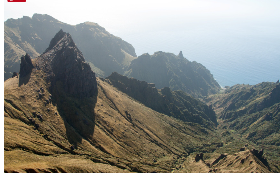
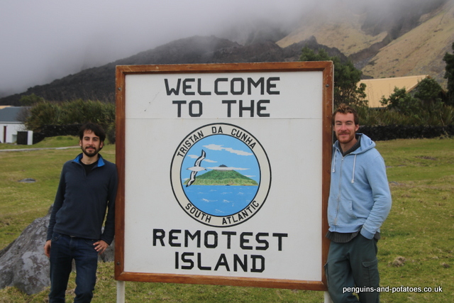
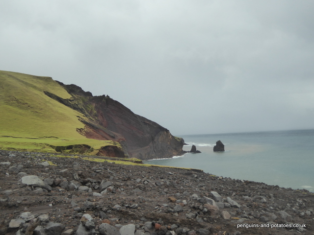
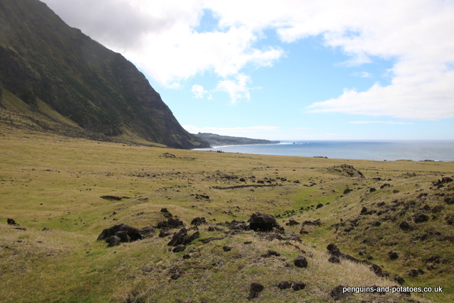
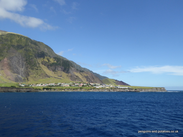
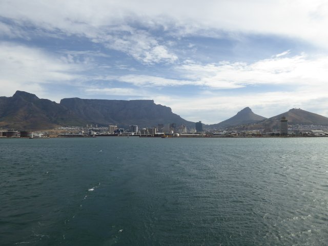
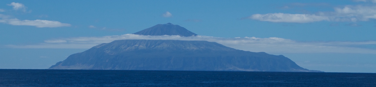
For anyone who knows about the island it would not be a big surprise to learn that Tristan does indeed have problems of self sufficiency.  This is a tiny dot of a volcanic island, deep in the south Atlantic and some 1600 miles away from its nearest port of Cape Town.  There are many factors that all contribute to it being difficult to produce a range of food crops on the island, and so a very large proportion of all the food consumed on the island has to be supplied through Cape Town.   Also, fuel and medical supplies all have to be imported and if the supply chain is compromised the lack of these essential goods could become critical.  As far as the UK is concerned, in spite of having one of the most advanced and capable agricultural systems in the world there has been a trend towards policy decision-making that has turned its back on the strategic and economic importance of the country producing its own food.  As a result of these policies, spearheaded by Tony Blair when he was in power, the country’s self-sufficiency in food has dropped from 78% in 1984 to just 60% today.  (This is calculated from a net import figure – imports less exports, and includes products that do not come to the table, such as livestock feed)

Tristan cattle – on a good day!

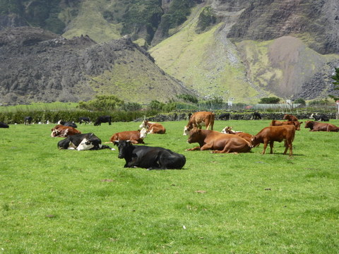
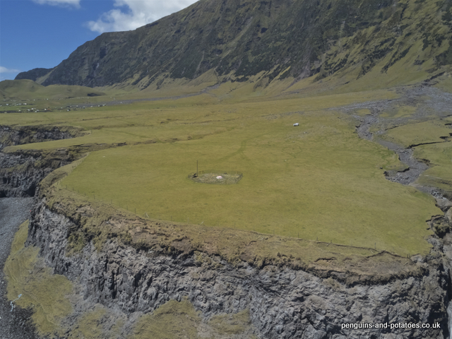
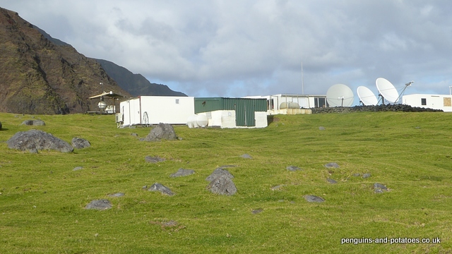
On Tristan, there are very few items that can be thought of as being available at a self-sufficient level.  These are limited to fresh water, fish, mutton, beef and potatoes.  Caution needs to be exercised when considering potatoes, because the annual crop is quite precarious.  The crop is grown year after year on the same ground and naturally there is a build-up of diseases and soil-borne pathogens.  Regrettably, a few years ago there were imports of seed potatoes from South Africa that were far from being disease-free, and in some cases yields from the ‘new seed’ were lower than yields from the islanders’ own saved seed potatoes.  There is always the risk of total crop failure, and when it is considered that the potato crop is the only source of island-produced carbohydrate a crop failure could be disastrous.

The potato patches

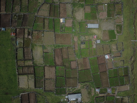
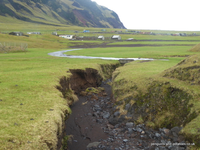
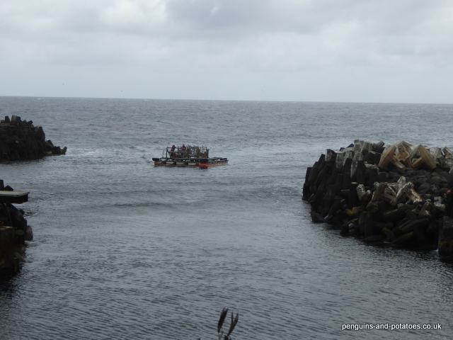
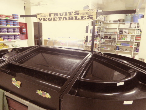
In days gone by the people of Tristan da Cunha were successful in being virtually self-sufficient in foodstuffs, even having a surplus that they sold or bartered to passing ships.  Since then the production of fruit and vegetables has greatly declined, particularly in recent years.  One of the factors for this decline in food production, ironically, has been the development of the fishing industry on the island.  This industry has resulted in eight ships a year now travelling from Cape Town to collect the catch, and it has resulted in the island having an income from the crayfish with which it can import a wide range of consumer goods, including fruit and vegetables.  The import of these consumer goods has taken away from the absolute need to be self sufficient.  As a result, individual gardens have largely fallen out of production and have been invaded by the New Zealand flax that makes such a good wind-break – but such a bad invasive weed.

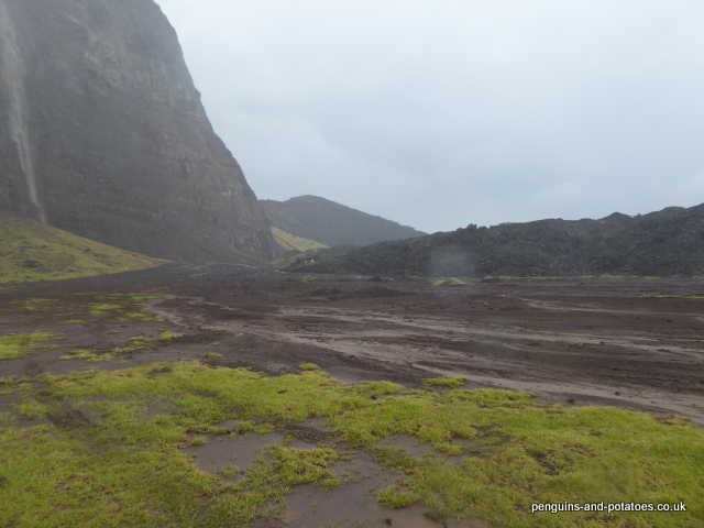
Vegetable production is difficult on Tristan – there are many factors that conspire to frustrate the would-be grower, including very harsh weather conditions and a wide range of slugs and insect pests that have arrived on the island and that have few if any predators.  Also, it is not always realised that proper production can only be achieved with an active programme of care, including pruning, weed control, and spraying when appropriate.  It is unsurprising therefore that many islanders now prefer to buy from the shop using their earnings that originate, essentially, from the sale of crayfish (“Tristan lobsters”)  This is all well and good when conditions are normal, but the island risks a food security emergency when, as in 2020, the world is thrown into unusual circumstances by the coronavirus pandemic.

The Edinburgh. The island is dependent on imports carried by two deep-sea fishing boats

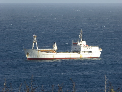
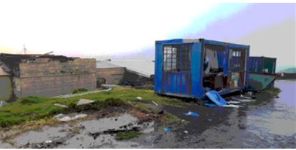
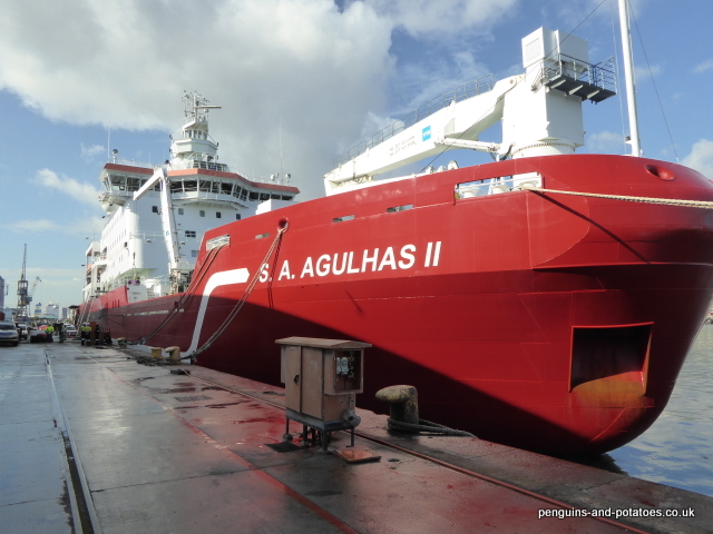
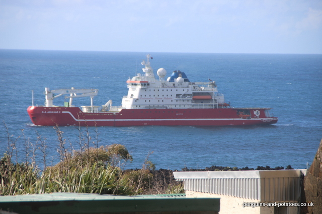
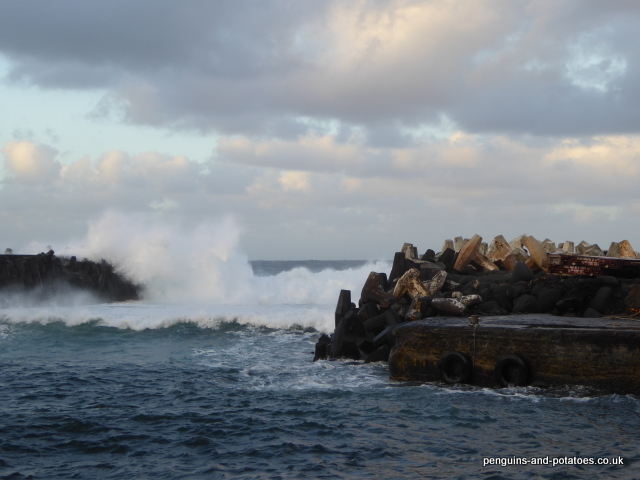
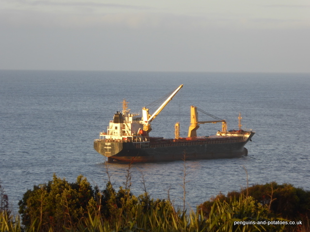
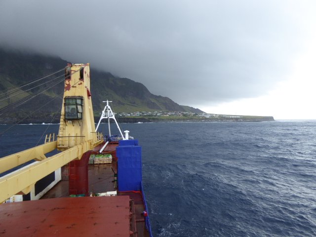
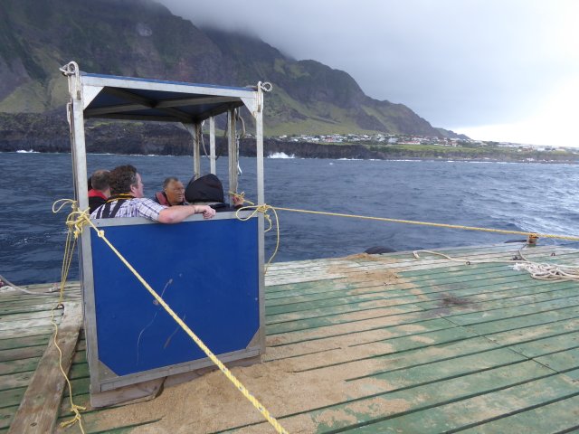
Around the time that the last ship arrived at Tristan, in late March, Cape Town was closing its doors to ships going in and out of the port, and to the supply of alcohol, fruit and vegetables.  It became apparent on Tristan that the supply chain was going to be badly affected, and with great foresight the Island Council put in place a rationing system for essential foodstuffs.  Even so, I understand that the shop warehouse ran out of rice, pasta and beer, and supplies of toilet rolls, milk, wine and other alcohols became perilously low.  The next ship to make the journey, the Edinburgh, had its departure delayed several times, and it did not arrive at Tristan until 30 June.  Even then the long-awaited stores could not be unloaded because of the sea conditions, and there were delays of 8 days and then 9 days while the ship sheltered from the weather.  It was perhaps just as well that no fresh fruit and vegetables had been shipped, because it is probable that it would have all have become rotten and have to be dumped.  Meanwhile, on another element of the same Covid 19 problem, the global marketing of the Tristan Lobster became difficult, and the island could no longer budget for the same income as before.

Empty shelves in the shop

Even now, at the beginning of September, the supply chain problem remains.  The next ship due to come out from Cape Town was due to leave on the 20th or 21st of August, but delays connected with the lockdown in South Africa have meant that the actual departure date has still not been fixed.

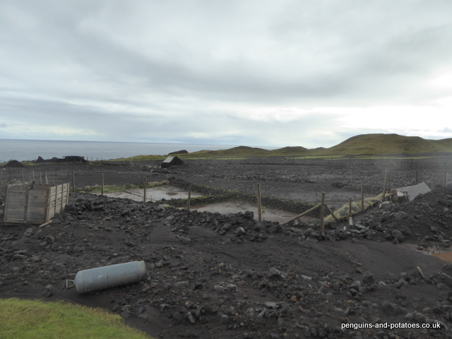
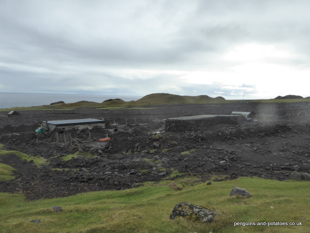
It is clear that the island has real problems of self sufficiency and of food security, and these problems have been highlighted and exacerbated by the coronavirus pandemic.  One problem is that there is inevitably a considerable delay between an islander deciding to grow more of his own food, and actually being able to harvest his produce.  It would take several years before an island population with a new-found interest in developing its self sufficiency could develop its garden land for efficient vegetable production.  In order to improve the island capacity to produce its own vegetables, a couple of years ago it was organised to set up a seed-bank, so that seeds are permanently available to the islanders – unfortunately the seed-bank was never established and it is understood that there are no vegetable seeds to be found on the island.  Seeds must be thought of as the beginning of the production process.

If we consider the UK, how can we possibly compare a country with a population of 66.65 million people, and the third largest economy of the world, with a tiny dot of an island in the Southern Ocean with a population of 245 souls?  The problems of self sufficiency in the UK are not on the same scale as they are on Tristan, and on the face of it there are no problems of food security.  (However, we are seeing unstable and uncertain times, and nothing can be ruled out)

In the last 40 years the UK has given away a large proportion of its agricultural turnover, by the nation buying elsewhere.  Now, only 50% of the food that is eaten is home produced, with as much as 30% now produced in the EU. The facts behind these figures make gloomy reading.  Over half of our vegetables are now imported, and over 300,000 tonnes of pasta a year are imported, 80% of which comes from Italy.  Even 20% of our cheese and our beef is imported instead of being home produced.  1.2 million tonnes of potatoes are imported every year, as are 55% of the tomatoes we eat.  We import 476,000 tonnes of apples every year, and 138,000 tonnes of pears.  All of these, apart from pasta, are commodities that we can (and used to) produce ourselves.  So, like Tristan da Cunha, our level of self-sufficiency has declined since the last war.

The situation with our apple industry is a typical example.  France took huge EU subsidies to develop vast industrial-scale apple plantations in south west France.  Our shops bought these low-cost apples, our shoppers were largely only presented with imported fruit, and the UK apple industry of Kent and Hereford was destroyed.

Apart from the political disregard for the strategic importance of our agriculture, and hence our self sufficiency, a number of other factors have come into play.  A large number of immigrants have come into the country, bringing with them a taste for a range of foods that cannot be produced in the country.  Our own interest in exotic foods has increased, partly triggered by a very high level of foreign travel.  In an increasingly affluent society, we no longer like to be restricted to fruit and vegetables ‘in season’, but we are prepared to pay for them 12 months of the year.  At the same time city centre and high-rise housing has been giving way to housing estates built on prime agricultural land, and increasingly the public has been developing the opinion that the countryside is for recreation rather than for food production.   We even have ill-informed pressure groups who believe that the country should be covered with trees in order to achieve carbon capture and to save the planet – they either do not know or they choose to ignore the fact that well-managed intensive arable land captures 5 times more carbon than trees, by means of the soil being boosted with organic matter (humus)

Three potato grow-bags on the pavement in Callander

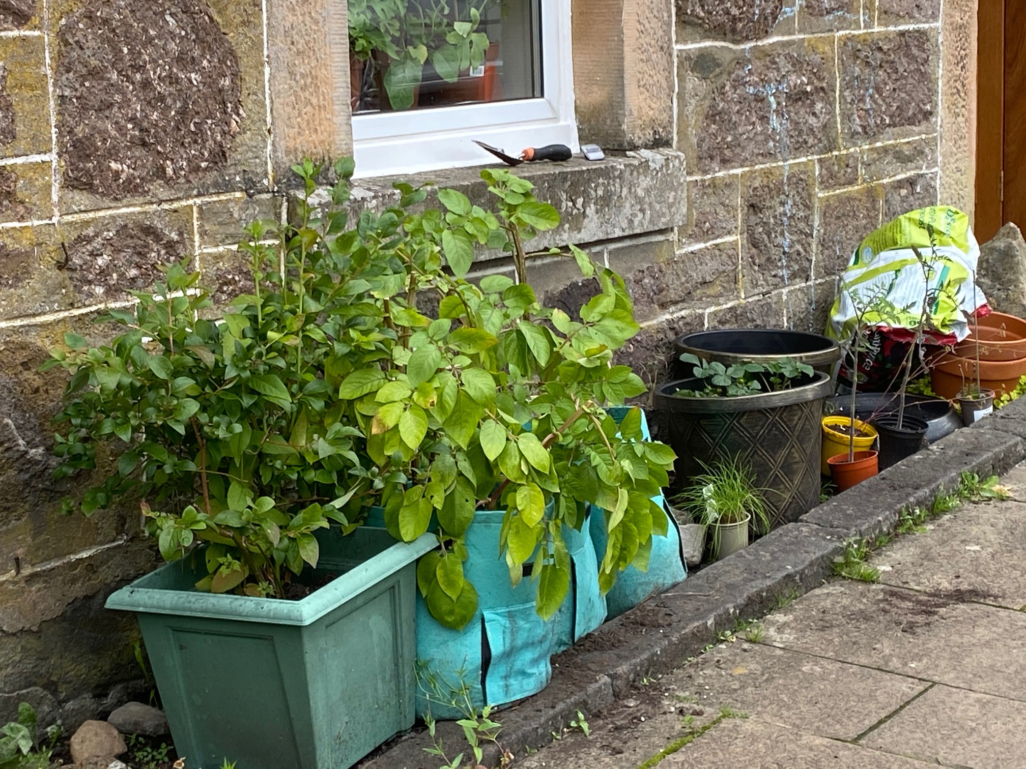
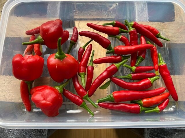
We have seen that the coronavirus pandemic has changed the situation in Tristan da Cunha, and in the same way the UK is experiencing some changes.  In the last five months there has been an increasing interest in home-produced products, and some of the supermarkets are increasing to launch promotions based on how much they obtain foods from within the UK.  At the same time, there is a percentage of shoppers who are more and more discerning – they no longer want to be fobbed off by, for example, beef that is produced in the USA, Poland and elsewhere to far lower standards than the standards that are to be found on British farms (this is not blind patriotism, it is based on scientific fact).  Another trend during lockdown has been the increased interest in people growing their own produce.  If every household in the country set up three potato growing bags outside their houses, around 180,000 tonnes of potatoes would be produced every year!  Clearly this is fanciful and could never happen, but it illustrates the potential for household production.  In our garden in Scotland we have produced some 18 different species of vegetables and herbs – that is all stuff that does not have to be imported.

First picking of our windowsill chilis


Extreme Storms on Tristan da Cunha

The last few weeks have seen extreme weather conditions of such a ferocity that they have been unusual, even for the windy island of Tristan.

The first storm-related events were in connection with the fishing- and cargo-ship the Edinburgh, which arrived off the island from Cape Town on 21 June.  She was carrying 12 passengers, fresh fruit and vegetables and other foodstuffs, and general cargo.  Because of sea conditions the passengers were unable to disembark and the ship sheltered in the lee of the island.  The following day there was a brief improvement in the weather, but a very bad forecast for the following week, and the unusual decision was made to anchor the Edinburgh to the east of the island and to take the passengers off in two RIB’s.  It must have been a very uncomfortable trip into Tristan’s tiny storm-bound harbour.

The weather was monitored closely to seize any opportunity to continue unloading, and an attempt was made on June 28 but had to be abandoned.  It was not until the 9 July that conditions permitted unloading to be recommenced in earnest, and the Edinburgh finally departed for Cape Town on 11 July.  Thus it was three weeks that the ship was at the island, waiting for the weather.  For the whole of that time the passengers who were due to depart on the ship were on permanent standby to go on board, with their bags packed, their good-byes said, and their refrigerators cleaned out.

This was just the forerunner of a very serious storm which hit the island on the night of 18 July.  An idea as to just how serious this was can be conveyed by listing the damage that was done by the storm.  The electrical system went down, and many buildings had some or all of their roofs stripped off by the wind – this included the Admin Building, the Police Station, the Post Office + Tourism Building, the Mechanical Workshop, the School, and the Residency.  The damage done by the storm was not limited to the removal of roofing and walling sheets, but since the storm was accompanied by very heavy rain there was substantial damage done to the contents of some of the buildings.  The extent of this damage is not yet known, but we can probably assume that most or all of the computers and archives have been destroyed.  One of the most serious losses has been the entire communications system, consisting of telephones and internet.  The island was dependent on the use of satellite phones to raise the alarm with the outside world.  Since then a line of contact has been arranged through CTBTO, which has a station on the island with a weak but functioning link to the outside world.

It is a great relief to be able to relate that no person was injured on the night of the storm.  There was also quite limited damage to any of the islanders’ houses, with just one house experiencing significant damage.  Also, the electrical system is now again operational, and by great good fortune the island shop and warehouse were not damaged, so food security is not an issue.

What is remarkable is the speed of the steps that have been taken by the British Government in the few days since the alarm was raised.  An extra-to-schedule ship will be leaving Cape Town in the next few days, bringing materials and equipment to get things repaired as far as possible.  Contractors have been appointed, and electrical and communication engineers will be travelling out on the ship.  Also on the ship will be the Administrator and his wife, who will be breaking off their UK leave and returning to the island to help co-ordinate the works.

The last serious storm to affect Tristan was on 7 June 2001, when 120-mph winds ripped roofs off buildings and when there was apparently heavy loss of cattle.

Part of the Residency roof ripped off
The Police Station – wrecked
The Mechanical Workshop – also wrecked
That’s my old office – and the puddle to the left is where the Agriculture staff tea room used to be
The blue box on its side is the 20′ container that we brought the two bulls in from South Africa – the brown patch is where it used to be before it lept the wall
The assembly hall at the school – where we watched Christmas concerts and where we played badminton


Tristan da Cunha and SA Agulhas ll

The word Agulhas means different things to different people.  To a geographer, Cape Agulhas is the most southern tip of the continent of Africa.  Many people would think that Cape Horn is furthest south, particularly with its fame among the trading sailors of the 19th century who “Rounded the Horn” on their way to India and the Far East.  Presumably, as these vessels navigated around the southern point of Africa the biggest change of direction was when they changed course around Cape Horn, whereas the change of course just 80 miles later, around Cape Agulhas, was a relatively modest change of angle, prior to the ships running almost due east along what is now the Garden Coast of South Africa.

Bee and Alasdair at Cape Agulhas – to the left is the Indian Ocean, and to the right is the Atlantic

Oceanographers will also know the name Agulhas after the Agulhas Current.  This is a major south-flowing current which runs down the east coast of Africa, roughly from 27o to 40o south.  It is a narrow strip of current close to the shore, varying between 30 and 100 km wide, and travelling at speeds averaging around 2 km/hr but at its maximum reaching speeds of 9.3 km/hr.

The Agulhas that is connected to Tristan da Cunha is SA Agulhas ll, which is a ship that is well known on a global basis.  The Agulhas is a South African icebreaking polar supply and research ship that is used as a platform for a wide range of tasks in the southern polar regions.  The Agulhas is owned by the Department for Environmental Affairs, and is operated by SANAP (South African National Antarctic Programme).  The link with Tristan is that every year the Agulhas passes from Cape Town to Tristan da Cunha, then she goes down to Gough Island 220 miles south of Tristan, where she carries out the change of the staff that are based on Gough for a year, dropping off one annual team and picking up the retiring team after their handover.  The Agulhas then returns to Tristan, and onwards to Cape Town.

Agulhas in her home port of Cape Town

On her way from Cape Town to Tristan the Agulhas takes a large quantity of cargo, and many passengers.  Last September the passengers included the RSPB team travelling out to Gough to do work on the mouse eradication project, two new teachers coming to Tristan, a number of islanders returning to the island from medical visits in Cape Town, a number of scientists coming to work on fisheries, birds and seals, a retail specialist coming to help the Tristan supermarket for six months, a large number of visitors coming to celebrate the 100th birthday of their relative on the island  –  and Bee and myself returning from leave!

The Agulhas has some big advantages for travelling out here compared with the deep sea fishing boats that are the other form of transport.  Firstly, she carries two helicopters.  One of the helicopters is used to take passengers ashore, which can be done even if sea conditions are stormy; thus there is virtually no risk of having to wait days on end while sea conditions allow the harbour on Tristan to be used.  The next advantage is that the Agulhas is a large and powerful ship, and is able to stick to a schedule under almost any conditions.  Visitors to the island are able to come ashore, and to have great confidence that they will be picked up 18 days later when the ship is on her return voyage.  The third advantage over the fishing ships is to do with passenger comforts – the Agulhas has stabilisers, comfortable en-suite cabins, good food, and good facilities including a gym and a couple of bars!

The Agulhas was built in Finland, and was commissioned in 2012.  She is built to “Polar Class 5” and is powered by four 3,000kw Waitsila engines.  Her ice-breaking capability is impressive, with a capacity to drive through 1 metre of ice at 5 knots.  An interesting feature is that her decks are heated, in order to prevent any build-up of ice in polar conditions.  The ship’s stabilisers are interesting – being an ice-breaker she cannot have stabiliser vanes sticking out of the side of the vessel, instead she has water balancing tanks which are joined by massive pumps, capable of pumping water from one side to the other in order to achieve a balanced trim.

One of the main engines in the immaculate engine room
The on-board machinery workshop – capable of any task

The ship has a crew of 45, and accommodation for a further 100 passengers.  With regard to her function as a scientific platform, the ship has 8 fitted laboratories and 6 further container laboratories, a library, as well as an auditorium for 100 people.

Our crossing from Cape Town to Tristan was trouble-free, and we made it interesting since I managed to organise visits to the engine room and to the bridge.  On the bridge we found the famous xylophone that is used as a dinner gong – it is a tradition on board that a crew member on the bridge announces meal times by playing a tune over the public address system!

The improvised dinner gong in the bridge

The Agulhas regularly carries out expeditions in the southern polar regions.  One quite recent expedition, in February this year, was to go down into the Weddell Sea and carry out scientific studies, particularly on the giant iceberg known as A68, leading to greatly increased knowledge of the climatic influences from that area.  One last mission, before the Agulhas left the Weddell Sea,  was to launch an AUV (Autonomous Underwater Vehicle) in order to search for the Endurance, Sir Earnest Shackleton’s famous ship which sank in November 1915.  The mission was not a success – they were on station and began their search on 11 February, but on 14 February, with deteriorating weather and sea ice conditions, the AUV lost contact with her mother ship and the mission had to be called off and the AUV abandoned.

The Agulhas off Tristan da Cunha (viewed from our garden)
The settlement of Edinburgh of the Seven Seas, viewed from the Agulhas helicopter


Mice on Gough Island

Tristan da Cunha is remote, by any standards.  But within the archipelago that Tristan encompasses, there is an island that is considered remote even by the people of Tristan. Around 220 miles further south from Tristan is Gough Island, named after Capt. Charles Gough of the ship called the Richmond, who discovered it in 1732.

Gough Island is around 13 km long and 5 km wide.  It is home to around 10 million seabirds as well as two species of land birds – the Gough Bunting and the Gough Moorhen.  In recognition of Gough being a hugely important place for bird life, with a unique largely unspoiled habitat, the island became a UNESCO World Heritage Site in 1995.  It’s classification was added to by being joined by Inaccessible Island (another small island in the Tristan archipelago) in 2004.

Gough Island is uninhabited.  However, for the last 62 years the South African Weather Service has had a lease arrangement with the Tristan Government, and during this time it has maintained a scientific base on the island.  Teams of staff spend an uninterrupted 12 months on the island, the main purpose of which is to monitor weather conditions in order to help with the forecasting of weather in southern Africa.  In addition to the meterologists, the team includes engineers and a medic. There are also normally three staff from the RSPB (Royal Society of the Protection of Birds) who are bird scientists, and whose job it is to monitor the bird population on Gough.

The South African met station on Gough Island             Photo – Richard Hall

The importance of Gough can be seen, for example, in the fact that 99% of the world population of Tristan Albatross nest on the island, and 100% of Gough Buntings nest there.  Both species are critically endangered.  There are also populations of a large range of other Albatross, Shearwater, Petrel and Prion species, some of which are also classified as being endangered.

Tristan Albatross and chick                                                                      Photo – Steffen Oppel

Around 2006, the use of camera traps was able to prove conclusively what a few observers had already suspected.  This is that mice were predating on the wild bird chicks.  Mice had been on the island for many years, probably brought there originally by sealers in the 19th century.  The mice lived in harmony with the bird population, their diet consisting of plant seeds and insects.  Then – they evolved into chick-eaters.  This evolution, the change in eating habits of mice, has been seen in a parallel situation on Marion Island, where by means of careful monitoring during the space of just four seasons, ‘normal’ mice had evolved into predators of bird chicks. The scale of this predation on Gough is enormous – in 2016 it was estimated that mice were responsible for the killing of 600,000 chicks.  Following a scientific study on Gough some weeks ago, this has now been revised and updated to 2 million chicks and eggs a year. There have been some quite gruesome pictures of groups of mice eating albatross chicks alive.  The interesting thing is that the parent albatross just looks on unconcerned.  One stab of the adult albatross beak could easily kill a mouse, and bear in mind that an adult albatross might weigh 2 kg as compared to a mouse of about 25 grams.  The problem is that the Albatross (and other species) have nothing in their genetic makeup to tell them that mice are dangerous.

Mice on an albatross chick – while the adult looks on                            Photo – Ben Dilley

The RSPB team stationed on the island, together with visiting specialists in September / October this year, came up with some alarming figures.  For example, they found that this year the population of the critically endangered Tristan Albatross reared just 309 chicks from of 1,435 nests – only 21% instead of the 80 – 100% that would be the target for the species to have a long-term future.

In recent years, just as there have been huge technical advances in camera traps and other monitoring devices, so also there have been major advances in rat and mouse eradication from islands.  Islands lend themselves to eradication programmes since, provided that strict bio-security measures are introduced and enforced, re-infestation can be prevented, whereas in any mainland situation re-infestation is inevitable.  There have been some highly successful island eradication programmes, including from South Georgia, Macquaire Island off Australia and Campbell Island off New Zealand.   All of these programmes have used helicopters with underslung spreaders that distribute pellets made of a cereal-based toxic bait.  The spreaders are standard agricultural fertiliser spreaders fitted with a small Honda engine, and the bait generally used is one of the second-generation anticoagulants called Brodificoum.

The world centre for this eradication work is New Zealand, and it was that country that the RSPB turned to when it set about the planning stages of an eradication programme on Gough Island.  Initially, the plan was to carry out the eradication programme in the winter of 2019, but this has now been postponed to 2020.  The winter months are chosen because it is at that time that there are no birds nesting, and the mice are keen to find all food alternatives – making them eager for the toxic bait that is used in the eradication programme.

In August + September this year, a small specialised team travelled out on the SA Agulhas 2, the ship used by the South African Government to conduct their annual maintenance and team-change visit on Gough Island.  This team was organised by the RSPB, and consisted of an eradication specialist and a specialist helicopter pilot (both from New Zealand), an aerial systems engineer, and a bird captivity and release specialist.  The purpose of the visit was to have a detailed look at the site so that they could modify and confirm a master-plan for the operation, in order to give this expensive operation the highest possible chance of success.

The interior of Gough Island showing ‘Hag’s Tooth’                               Photo – Richard Hall

The overall plan is that in the early winter of 2020, a logistical team will travel out to Gough Island, to take out stores and set up accommodation on the island – a team of around 30 people will be needed.  The bird captivity and release specialist will be in this advance party.  His role will be to set up a large aviary-type structure, and to capture a good number of buntings and moorhens to act as a security population.  If these species suffer from poisoning of the toxic bait, at least there will be a protected reserve of such birds in captivity, available to be released when the active bait is no longer present on the island.  The albatrosses and the rest of the sea birds do not pose a problem in this respect – the do not come to the island during this time of year, and in any case they do not eat while they are onshore.

Once all the on-island preparations have been completed, the dosing team will travel to the island on a second ship.  This team will include four helicopters (one as a reserve) and a whole team of specialist pilots.  The systems engineer sets out an electronic GPS-based grid pattern of the routes to fly to ensure 100% coverage – indeed each swath is arranged to give 50% coverage of the previous swath, thus arriving at a double dose of the toxic pellets for any given area.  Two applications of bait would be spread, ideally 3 weeks apart for maximum effectiveness.  The winter in these latitudes can be very severe, and it is anticipated that with any lull in the weather the team will have to work from dawn to dusk, to seize the opportunity before the weather closes in again.

No-one is pretending that the task will be simple.  Mice are more difficult to eradicate than are rats, partly because they can find protection from the weather (and the toxic bait) in all sorts of caves and holes.  The whole project is expected to cost in the region of £9 million.  The success of the project will be measured by two elements.  Firstly, 100% kill of the mouse population is needed.  If a single breeding pair remain, then the breeding birds will just have a short respite until the mouse population once again builds up to the present levels.  Secondly, it is vital that the bio-security arrangements in Cape Town and on the island must be so thorough and so effective that there is no possibility of the re-introduction of mice in the future.  I am sure that everyone involved in the project knows full well that they have just one chance to succeed.

A group of Yellow Nosed Albatross, nesting on Nightingale Island

High-tech Tristan

Tristan da Cunha can not in any way claim to be particularly high tech.  In a practical sense, levels of both mechanisation and automation are well behind most other countries.  There is no system for the use of credit cards, and there is no mobile phone system.  Government and Departmental accounts have only just been digitalised, and the internet is not at all reliable, to say the least.

Yet, the island is home to some of the most high-tech installations imaginable.

The UN organisation CTBTO has a monitoring station on Tristan.  The Comprehensive (Nuclear) Test Ban Treaty Organisation was formed in 1996.  Over 180 countries have signed up to the Treaty.  In the original documentation there were 44 countries listed as being countries with nuclear capability, and signatures from all of these were needed before the Treaty could become Law.  It is noteworthy that 8 of these countries have yet to sign (China, Egypt, India, Iran, Pakistan, Israel, N. Korea and the U.S.A.)

World map of CTBTO installations

The history of nuclear testing goes back to 1945, when the U.S.A. tested a device in New Mexico.  Between then and 1996, over 2,000 tests were carried out worldwide.  Of these, 1,032 were carried out by the U.S.A., 715 by the Soviet Union, and 210 by France.  Between 1945 and 1980, nuclear tests have totalled 510 Mt (mega-tons), of which the atmospheric tests totalled 428 Mt – equivalent to 29,000 Hiroshimas.

Since 1996, there have been just 10 nuclear tests.  India and Pakistan each carried out 2 tests during a period of sabre-rattling in 1998, and North Korea has been responsible for 6 tests.  All of these tests were detected by the CTBTO.

This is the background to the CTBTO.  The monitoring station on Tristan is one of about 250 around the world, with around 320 eventually planned.  Clearly, the island is wonderfully well placed to host a monitoring station, in that any signals that are detected can be accurately triangulated with other monitoring stations in countries on either side of the Atlantic Ocean – and there are no land areas anywhere near that could provide the same service!

Each CTBTO monitoring station measures, with extreme accuracy, a number of parameters that are able to detect and record that a nuclear explosion has taken place.  The wealth of information that is generated is transmitted in real-time to the IDC – International Data Centre – in Vienna, where the central computer system can immediately identify that a nuclear explosion has taken place, and exactly the location of the explosion.

On Tristan, as is the case with all the other CTBTO monitoring stations, three distinct physical parameters are monitored.

  1. A network of sensors monitors infrasound waves, using micro barometers which are able to detect minute infrasound pressure waves.
  2. Air quality is monitored, the sampling being aimed at detecting evidence of nuclear activity as well as being able to determine the type of nuclear device.
  3. Seismic movement is detected by a group of 3-axis seismometers –  information from these instruments could also be useful in giving advance warning of active volcanic activity on the island.

The first category of sensors takes place on the Western Plain, beyond the Potato Patches.  There are five separate sensing units, each having four sensing hub.  Each hub has around 24 tubes radiating from it, like spokes of a wheel.   The purpose of this arrangement is to average out all variations in infrasound waves, to arrive at a true reading. Computer triangulation of the signals received by the five sensing units determines also the direction of the nuclear explosion.  Readings are sent by a microwave system to the station’s central computer, where they are computed and sent continuously via satellite link to Vienna.  One of the five sensing units also has a chamber in which, as well as the electronic package that looks after the infrasound information, there is a seismometer, ready to sense and calculate any tremor in the earth’s surface at that point.  As part of the fail-safe technology that is part of the station, whenever the cover is opened on the chamber notification is instantly sent to Vienna.

The western plain looking west, with a CTBTO sensing station in the mid-foreground   (Pic – Bernard Pronost)
Overhead shot of one of the sensing stations   (Pic – Bernard Pronost)

The remaining elements of the CTBTO station are all to be found in a cluster in the field immediately to the west of the Settlement.  For determining air quality, there are two distinct systems used.  The first machine is called Snow White, which is manufactured in Finland.  This unit samples 20,000 cubic metres of air each day, collecting all particles in the air onto a filter pad, which is then removed and compressed into a wafer by processing it in a hydraulic press at 400 bar pressure.  After 24 hours, the wafers are placed in a spectrometer, which is able to identify around 12 substances that are known to be produced by nuclear explosions.  The technology that is required in this process is impressive, and it requires temperatures below -220 Centigrade, and electrical voltages of over 2,000V. The second system is made in Sweden and is called Sauna.  This unit samples the noble gas xenon, and identifies the isotopes of that gas.  In the event of a nuclear explosion, the ratio between the four isotopes will determine what sort of bomb is being detected.

Snow White

Seismometers are also located in chambers nearby.

The CTBTO station is managed by a French company, with a French station manager on the island.  For the last two years, Leo Duval was on Tristan.  We have just had a handover to the new station manager Maxim Sanders, with Maxim Le Maillot actually doing the handover.  Maxim Le Maillot was Leo’s predecessor, so he knew well the island and the installation.  Each of these station managers are known on the island as “Frenchie”, which is a simple system for most of the year but which can cause a little confusion when there are two of them here!

Former Station Manager Leo Duval
A pair of “Frenchies” – new Station Manager Maxime Sanders (left) and former Station Manager Maxime Le Maillot (right)

There are two other monitoring stations on the island.    The first is a station that was set up in 2004 by Austrian Jurgen Matzka for the Danish Magnetic Institute.  Jurgen is now with the German Research Centre for Geosciences (GFZ) who now have taken over the station.  This station measures changes in the Earth’s magnetism.  Generally, these changes reflect changes in the Earth’s core, but they can also react to local influences such as the construction of the new hospital, or even someone with metal buttons on his jacket walking too close to the sensing unit.  The station is accurate enough to measure changes in magnetism of one thousandth of a degree, which Jurgen likens to kicking a football through a goal which is 500km distant!

Finally, in the same field there is a third monitoring station.  This one is operated by the USGS (US Geological Survey) and consists of seismometers that are specifically set up to monitor volcanic activity, earthquakes and landslides.  The information from these seismometers is continuously being monitored in the United States. The USGS was set up in 1879, and is set up to monitor a wide range of natural sciences around the world.

General view of the “high-tech” field


Devastating Floods On Tristan

In the region of 200,000 years ago, one single volcano spewed billions of tons of rock out from the floor of the South Atlantic, and the island of Tristan da Cunha was formed. From the very time that the classic cone-shape was formed, the forces of nature began to beat and weather the newly emerged volcanic rock. Rain would be the main agent to erode the rock face, and the softer rock would erode most easily. At the same time, all around the shore the constant action of wave impacts would cause sea erosion. Year after year the process of erosion would continue, and year after year material eroded from the high ground would be deposited on the coastal fringes. Bit by bit the coastal plains would be built up with boulders, stone and grit from the high ground. Thus, over the years, the coastal plains would be formed, the biggest of which of course is the Settlement Plain. The plain is full of evidence of boulders and other material coming down from the high ground, reflecting years of particularly heavy rain. At the same time the rock and grit deposits on the plain would themselves be eroded by huge streams of water, cutting out the gullies and taking the deposits down to the sea.

It is clear that some years this process of erosion and deposition is relatively gentle, but some years the rain is unusually heavy and the erosion action of the rain is unusually high. Either because of the normal cyclical nature of weather patterns or perhaps because of global warming, we have seen very heavy rain in recent years. Last year we saw the land-slip across the road leading to The Valley being formed. This year, we have seen the worst floods and flood damage in living memory.

It all started, really, on April 14th. On that day there was continuous very heavy rain for a long time. The waterfalls were all in full force, the watrons (streams) were running hard, and people either kept indoors or went out in wellies. The gritty soil and sub-soil on the island drains very freely, and by the following day the signs of flooding were starting to disappear. Then came the night of the 17th / 18th.   Falling on ground that was already waterlogged, very heavy continuous rain caused storm damage of biblical proportions.

Devastation at the Potato Patches
Overview of the ruined Potato Patches

In the middle of the night, it became apparent that action was necessary to save properties that were being threatened by the flood. The Settlement street lights were switched on, and a small team of ‘action men’ turned out with a JCB, diverting rivers of water from the houses, particularly to the east of the settlement where the Big Watron was substantially overflowing its banks.

Towards the Settlement looking over the Big Watron – and the completely hidden cattle grid

The following day, and for a number of weeks, damage repair work was carried out on a priority basis. Help was given to some householders whose homes had been flooded. Gates were put up to take the place of cattle grids, which had been filled to the top with stone and silt. Also, the PWD (Public Works Department) turned out in force, partly to cut some sort of a roadway through the massive new fields of stone and grit, and partly to make temporary repairs to the erosion that had taken place in some of the gullies.

In the two days of heavy rain, 132mm of rain fell. This is not in itself a phenomenal amount of rain, but it comes after a very wet year. Already this year, five months in, we have had over three-quarters of the annual rainfall average

One of the of the questions that this emergency has raised is to try and find out the overall reason for so much land material being swept off the Base (The Base is the high land, running up from the top of the coastal cliffs right up to the Peak), because the main part of the damage done has been caused by alluvial deposits, rather than simply running water. It is clear that considerable erosion is taking place on the Base. Even some weeks after this awful event, when a heavy rain caused the waterfalls to run it was clear that there were white waterfalls and brown waterfalls. The brown waterfalls evidently had very heavy loads of silt and stone being washed off the Base. The unanswerable questions that need to be asked are along the lines of :- Is this amount of erosion simply a consequence of very heavy rain? Are we seeing increased rainfall as a result of global warming? Are there environmental reasons for this high level of soil erosion, and in particular is there a possibility that grazing by sheep has exposed the soil on the base to increased weathering? It will be very difficult to obtain factual evidence to support any particular theory, since there is a lack of survey information that measures, analyses and describes the situation on the Base, and access at the moment is dangerous and highly restricted. If we had a resident helicopter the task would be easier!

The damage that has been done can be divided into the following categories:-

  1. House flooding. Individual householders have been faced with flooded homes. Some carpets have been ruined, and the drying-out process has caused hardship to individual families
  2. Cattle grids. Three cattle grids have been filled to the top with silt, rendering them totally ineffective – cattle can walk across them with ease. As a result, a new gate has been installed in one case, and in two cases cattle have had to be moved from their normal pastures because they can no longer be retained by the cattle grids. The Agriculture Department is faced with the task of rebuilding these cattle grids.
  3. The road system has suffered greatly. Within the Settlement there is considerable evidence of the road structure being weakened and eroded. On the road to the Patches, there are whole lengths where the road has been completely washed out. In other sections, new potholes have been formed, and there is plenty of evidence of erosion causing further damage and vulnerability.
  4. Water troughs. Silt has been washed down the hill, in one case completely burying a cattle drinking trough.
  5. It is believed that around 12 sheep were washed out to sea by the floods, and one dead cow has been found half buried in the stone and grit deposits. It is assumed that these animals were sheltering in the gullies when they were overcome by the water.
  6. Gully road crossings. Three gullies on the road to the Patches were deeply eroded, making them impassable to any vehicle. PWD rapidly sent out excavators, and quick repairs were made by constructing barriers of boulders on the lower side of the crossings (known as ‘rip-rap’ to land engineers) and infilling with silt and gravel in order to make the crossings usable.
  7. Land slips. These are probably better described as alluvial fan deltas, rather than land slips, since they have been formed by water-borne boulders, stones and silt being washed down from the high ground and progressively being deposited on the slopes as the flowing water lost its momentum, rather than the mountainside slipping away en masse and being deposited on the plain.   The area and volume of the land slip which was formed last year increased considerably – perhaps its volume trebled. But the main devastation was caused by an entirely new slip or delta that swept down from the area of the Base that feeds Wash Gulch and which covered an area of about 70 acres. The grazing area that this slip covers, together with a number of smaller deposits, are now of no use at all to our grazing cattle.
  8. Potato patches. The Red Body Hill Potato Patches have essentially been destroyed by the new land slip described in the above paragraph. Some 15 – 20 Patches are lost. It remains to be seen whether anything can be done to restore these areas, or whether these Patches are lost for ever. What is certain is that if the island embarks on any programme to recover these potato growing areas, the work will be difficult, time-consuming and expensive.
  9. While in some areas valuable pasture land has been covered up by silt and stone, in other areas erosion has removed pasture and washed it away. For example, large areas of the seaward side of Hill Piece have been lost by erosion, before and after photographs showing the extent of the loss of grazing land. Meanwhile the sides of all the gullies have been eroded by the force of water, and more grazing land has been lost in these areas.
Erosion in in a watron through the Potato Patches
The seaward side of Hillpiece – just look at all the land loss
Slip of pasture land in Hottentot Gulch

The people of Tristan da Cunha are known for being able to respond to natural calamities in a pragmatic, practical and co-ordinated way. That has already been evident with the works carried out in the last weeks since the floods. During the coming months, a wide range of works will be carried out as part of the flood recovery effort. However, there is one aspect of island life and the island economy that will take a severe beating from this flood calamity, and that is the situation with the cattle. It is well established and well recorded that there has been substantial overgrazing by cattle for very many years. The overgrazing problem, simply caused by having too many cattle for the land resources available, has all of a sudden been made very much worse by the flood damage. The approach into winter is the very worst time for the island to suffer a reduction in the grazing surface of around 10 – 12%. The Agriculture Department is making all effort to minimise the impact of the flood related problems, but it is felt that there is increasing awareness of the strategic danger of having too many cattle for the carrying capacity of the land.

Life on Tristan (1)

In order to try and describe how our life has been for the first four months on Tristan, I have to start by describing some overall details of this exceptionally remote island.

Tristan is a volcano, and quite a new one at that. Some 200,000 years ago there was the series of eruptions that caused the island to be formed in the middle of the South Atlantic Ocean. Thanks to the previous volcanic formation of some islands in the area (such as the tiny islands of Nightingale and Inaccessible) the ocean floor around Tristan is relatively shallow – only around 2,000 metres deep, as distinct from 4,500 metres deep over much of the Southern Atlantic.

Once the main landmass was formed, the forces of nature immediately started to attack the classic conical shape of an isolated sea volcano. Around the coast, wave erosion cut into the coastline, heavy rain caused erosion from the high ground, and at the same time new mini-volcanoes appeared, providing a complexity to the classical conical shape. This dynamic process is continuing to this day, and it will continue into the future. The 1961 eruption, which happened to be very close to the settlement of Edinburgh of the Seven Seas, was just a part of this dynamic process.

Tristan remains a classic conical volcano; the island is round like a clock face, and it is possible to pin-point features around the coast by reference to the clock. For example, Edinburgh is at 11 o’clock, Sandy Point is at 3 o’clock, Stony Beach is at 6 o’clock, and the Caves are between 7 and 8 o’clock.

The ‘Clock’ of Tristan

The four places mentioned in the last paragraph are the four places where there is flat-ish ground and where there is some form of agricultural activity. In the past, particularly between the 1950’s and the 1970’s, there was quite a lot of agricultural work at Sandy Point – including the growing of potatoes, and the planting of apple trees and forestry trees (largely conifers and eucalyptus). Sandy Point enjoys a much more benign climate than the rest of the island, being in the lee of the strong prevailing winds, and the forestry trees have been very successful. However, access is the problem. There are no roads on the island other than on the Settlement Plain, and sea access is hazardous and only possible when the weather is right. In the past people made quite frequent journeys to Sandy Point, but now calm sea days are devoted to the fishing for crayfish and the men of the island have no time to tend the apples and to grow potatoes in this difficult terrain. I have been told that up to about twenty years ago, every year one day was designated as ‘Hapling Day’ (Apple-ing Day) and up to three longboats full of apples returned to the Settlement, but that is now all in the past.

Nowadays, the three outlying flatish areas are used for the grazing of cattle, which are very much left to fend for themselves. I have been lucky enough to go out to The Caves and to Sandy Point by joining teams of men going out to slaughter cattle for meat. In each case the process was much the same. The party set off in the ‘Government Launch’ with an oar-powered boat in tow. On arrival off the beach, the shore party transferred to the small boat and rowed ashore, leaving two qualified boatmen in the launch – it is not possible for the launch to land, and two men are needed for safety reasons. The islanders have enough experience of the hazards of the sea to have developed strong safety procedures.

View from the pasture land at the Caves, looking south towards Stony Point

When I went to The Caves, the oar-powered boat was taken ashore in relatively calm waters, but frighteningly close to the roar of breakers on a reef. The boat was beached at speed so that it rose up onto the gravel beach and as one the men jumped ashore, and we all pulled the boat up well clear of the water. Even with the boat high and dry two shore-lines were tied so that there was no risk of the boat departing on its own.

Our boat at the caves

[Pic – LT2 – Caption = Our boat at The Caves]

The slaughter process was done with rifles, not unlike shooting deer. The cattle were pretty wild since they are never handled. Just one cow was shot, butchered, loaded up into big plastic bags and carried to the boat.

On the return journey, two men stayed in the small boat with the meat while the rest of us transferred into the launch. The men in the small boat were then able to handle the boat and tie it up when we were back in the harbour. For me, it was interesting and exciting to see the island from a different vantage point.

Returning to the harbour

The second meat trip I did was to Sandy Point. I had read a lot about this place in Agricultural Officers’ reports dating from the 50’s and 70’s, and I was very anxious to visit it. The opportunity came up at short notice. On that day I had organised a Field Visit to our little Greenhouse project for members of the Agriculture Committee. When I started work at 6.30 that morning I learned that three of the five people expected would not be coming – they each had arranged to do more important things. I also learned that a boat was going to Sandy Point, departing in about an hour. So I cancelled the Field Visit, borrowed a lifejacket, picked up a bag with a sandwich (thanks to Bee) my waterproofs and a camera, and headed to the harbour.

The journey around the coast was uneventful, but the seas were higher than had been expected, and landing the small boat on shore was going to be challenging. The communication between the men on the oars as we approached the beach was interesting – voices were louder than usual and there was an evident tension. For the ‘final landing’ we made it – just! The boat was not maintained stern-on to the waves, and we broached. The starboard gunwale had six inches of water pouring over it, and most of the men ended up waist-deep in the water having exited the boat rather more quickly than they had intended!

Sandy Point – steep ground and trees

I remained with members of the group until the steer was shot – that way they knew where I was and the risk of a shooting accident was avoided! Incidentally, I did notice that the procedures for gun safety were well developed and strictly followed. These are high-powered rifles, and when not required for cattle slaughter they are stored in the armoury in the Police Station.

All habitation on the island is included in this view of Edinburgh of the Seven Seas

TdC Shipping

We have seen at first hand how difficult things can be on Tristan da Cunha.

I am referring to shipping, and the flow of essential goods arriving and leaving the island.

Like all islands, Tristan is entirely dependent on shipping.  Most inhabited islands have the benefit of a sheltered bay, a natural harbour, or otherwise some shelter for its man-made harbour.   Here, a new small-boat harbour was built on an exposed storm-prone coastline in or around 1965.

The entrance to the Harbour on a non-loading day

The unloading process into this tiny harbour is intrinsically difficult.  Ships anchor off, about ½ mile outside the harbour, and one, two or occasionally three motorised rafts ferry the cargo from ship to harbour.  Each raft needs a crew of four, and takes up to 20 tonnes of freight.   Once the raft is inside the harbour and tied up, the freight is unloaded by a large crane, generally onto an awaiting tractor and trailer which shuttles the item up to where it is needed.

One of the rafts that shuttle 20-tonne loads from ship to harbour

The main revenue-earning product that leaves the island is crayfish, known in some markets as Tristan Island Lobster.  This provides the main revenue stream for the island, and paid employment for a large proportion of the islanders.   But  –  and it is a big ‘but’  –  this economic and monetary life-line is only as good as the harbour and the shipping links to the outside world via our nearest port of Cape Town (some 1,600 miles to the east)

In the same way, everything coming onto the island does so via this link of long shipping journeys and a harbour that is accessible only in very good weather.   Machinery, building materials and other capital resources come in via this route.  But also it is the only route for essential items like fruit, vegetables, flour, sugar, gas for cooking, diesel for the cars, and so on.

So – I have outlined how important the harbour is for the survival of the community here.  Now let me describe the reality of how difficult it can be.  We arrived on the Baltic Trader.  When we arrived there were two other ships involved.  The Edinburgh was elsewhere in the islands, fishing for crayfish when weather permitted and due to come back to upload stocks of crayfish from the factory here to take to Cape Town, and the Glory which was sheltering in the lee of the island.  The Glory carried a ‘kit’ of construction materials for the new hospital that is being built here.  She arrived here on 4th November, and started unloading before the harbour was closed due to bad weather and heavy swells.  A 12-man construction team were on the island, and they only had components for the hospital to last until about December 27, after which they would be twiddling their thumbs.

Craning off wall panels for the new hospital

We arrived on the Baltic Trader on November 30th.  After we were unloaded into the harbour, with just the hand luggage that we had in the tiny cabin on the boat, the harbour was again closed and it was seven days before conditions allowed it to open again, to resume unloading.  That is when we received our suitcases, and the shop received tons and tons of food items.  This little window in the weather was insufficient to finish the job, and the harbour was once again closed.

‘Unloading Day’ is a big day here.  It is an ‘all hands’ day, in which all Government departments pool their resources, and all staff concentrate on the task of unloading.  When there is a ship to unload, an assessment is made very early in the morning to ascertain whether unloading will be possible, looking at actual weather, up-to-date weather forecast, height and direction of swell, and so on.  If an unloading day is deemed to be possible, the community is notified by the ringing of the gong at 5.30 in the morning.  The gong is a suspended gas bottle, sited centrally just at the back of the pub, and twelve strikes on the gong lets everyone know what their priority is for the day  –  an unloading day has been declared!

An unloading day is declared

The next time that there was an unloading day, on 12th December, it was the Edinburgh that was given priority.  The team were able to complete the backloading of the crawfish in the day, and the ship was able to set course for Cape Town  –  one less vessel in the queue!

It was not until December 22nd  that the gong was again heard, and the Baltic Trader opened her hatches for unloading to continue.  Two hundred tonnes of building stone for the harbour were unloaded, then there was backloading of empty 3 tonne petrol tanks, empty gas bottles, one sole passenger and 35 tonnes of frozen crawfish went on board, and the Baltic Trader left for Cape Town before weather conditions once again closed in.

Two down, one to go!  On the 24th work started once again on the Glory, Christmas Day was foul and no unloading took place, but finally on Boxing Day the remaining materials for the hospital were unloaded and as darkness approached the ship was able to set course for Cape Town.

The Glory was in total 51 days at Tristan da Cunha, for a total of 11 days unloading.  She was here for so long she even transferred 4 tonnes of fuel from the Baltic Trader – the only alternative of which would have been to go all the way to Cape Town simply for fuel, which in itself would have taken the best part of three weeks.

These are just some of the logistical problems of getting things done on the Remotest Inhabited Island in the World.

MV Glory on her last day at the island

Cape Town to Tristan da Cunha

Our departure from Cape Town was scheduled to be on Thursday 17th, but it was (initially) delayed a day.  Unfortunately, our hotel had no availability on the night of the 17th, and we had to move to another place. The delay was caused largely by the decision to load stone which was needed for some urgent repairs to the harbour wall on Tristan.

We were to travel on the ship called the Baltic Trader; eventually we had the call to be ready for our transport to the ship on the Sunday morning (20th) at 7.30, which was later extended to 9.00 for a ship departure of 11.00 – ish.   With us in the hotel was a geography teacher heading to the island on a 6-month contract.  When we arrived at the ship, we saw our baggage loaded, and then we were joined by the new Administrator and his wife and we were all taken off to Immigration.

Here there were some anxious moments when the Immigration officer refused to accept the passenger list that he was given – he was right, the list that was offered was for a previous sailing!  Anyway, the matter was resolved quickly and with good humour, and we felt that we were a step closer to our departure to Tristan da Cunha.

Once the main engine was started up, we had feelings of “all is well” which lasted quite briefly, in fact until the engine was shut down again!  There was a flurry of activity among the ship’s crew, and we learned that the cooling water intake was obstructed.  The diving company arrived promptly, and before long they had the obstruction cleared – large pieces of plastic 1 tonne bags, oddments of rope, and bizarrely a crisp packet.  This collection of plastic debris was almost inevitable, given the huge amount of plastic that was drifting around inside the harbour.

A diver goes in search of our cooling water blockage

Two small tugs arrived, and we were given a ‘dead pull’ straight away from the harbour wall, to distance us from the worst of the floating plastic before the main engine was re-started.  Finally, at around 4.30 in the afternoon, we left the harbour, leaving an angry tug-boat crewman contemplating his hawser which had had to be cut as a result of a jam on board our ship.

Someone cut my rope!
Somebody cut my rope
Leaving Cape Town – Table Mountain on the skyline

The weather and hence the sea state when we left was challenging, particularly for the first day out, with a quartering sea causing an uncomfortable motion, but day by day it moderated and by Wednesday it could be described as perfect, with a gentle following breeze, an almost cloudless sky, and a sharp horizon.

On the Tuesday we went past a group of whales – perhaps six or eight of them heading in an easterly direction.  I think that altogether there were five days when whales were sighted, but none of them were very close.  The further west we cruised, the more we were accompanied by birdlife, including yellow-nosed albatross and wandering albatross to remind us that we were  deep into the Southern Atlantic.

Yellow-nosed Albatross

Although for some dizzy hours we managed 8 knots, we spent most of the time with head winds and our speed was reduced even as slow as 3.1 knots at times  –  it is an awful long way to go at that speed!

Coming into Tristan da Cunha – early morning arrival

Early in the morning of the 30th we finally made it to the island.  We had read about the unloading arrangements, and expected the manoeuvre to be exciting.  It was!  In groups of six the passengers were ushered into a metal box about the size of a confessional (not that I would know!)   A hook from the ship’s derrick was attached, and we were hoisted way up into the air and over the side of the rolling ship.  We were then landed on a motorised pontoon that was waiting alongside.  The object of the exercise was for the crane operator to judge the touch-down of the confessional with the pontoon going down in the swell, to give us a soft landing.  In our case he mis-judged the landing and we arrived on the pontoon with a spine-jarring crunch.

The Confessional

The unloading and getting ashore gave us our first experience of Tristanian boat handling and stevedoring skills, which were impressive to say the least.  Details to follow in later blogs.

I will outline some details of our arrival on shore later, but there is a quick foot-note here.  We were so lucky to get off the ship when we did – that morning the wind rose once again and unloading had to be called off.  It was a week before unloading was able to restart and before we saw our luggage.